Punta Baretti (4013 m a.s.l., Mont Blanc)
Register and log summit
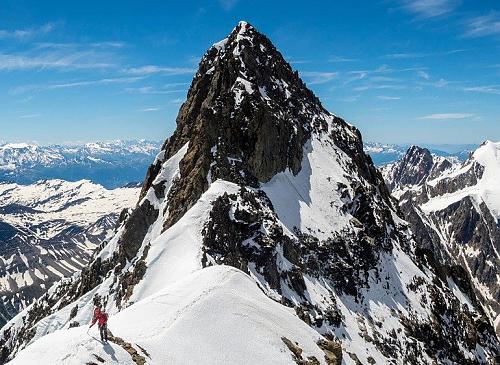

About peak Punta Baretti
 Itálie
Vrchol Punta Baretti was added here by Milan "Hojší" Průžek and info was completed by Milan "Hojší" Průžek a Bouřka.
Punta Baretti is part of challenges: 39 quattromila italiani, Alpine Four-thousanders
Punta Baretti is located on the Brouillard Ridge leading from the south to Mont Blanc de Courmayeur. It exceeds the four-thousand-meter mark by only 13 meters and should not actually be considered a separate peak, as the surrounding terrain is only slightly higher.
The summit is named after its first ascender, geologist and alpinist Martino Baretti. It is rarely the goal of climbs, usually being ascended as part of the traverse of the Brouillard Ridge. It can also be reached from the Eccles bivouac (also known as Lampugnani) via the Emile Rey pass. For advanced skiers, there is also a descent via the SW couloir.
- Extensive, six-kilometer-long rock wall, essentially on the Italian side, bordered on one side by the Brouillard ridge and on the other by the Aiguille de Bionnassay.
- It is the least known side of Mont Blanc.
- Large, firn-covered walls, above which several beautiful rock spurs rise, are climbed very rarely.
- An exception is the route via the Aiguilles Grises, which is the Italian Normal Route to Mont Blanc.
The summit can be reached from the Rifugio del Goûter (3817 m) and Rifugio Torino (3375 m).
The mountain was first ascended on July 28, 1880, by Jean-Joseph Maquignaz and Martino Baretti.
- Chalet/accommodation
-
There is no chalet on the peak.
- Stroller access
-
Peak is not stroller accessible.
- Views
-
There are views from the peak.
- Cable car
-
There is no cable car to this peak.
- Equipment
-
Special equipment is required for this summit.
- Accessibility
-
Peak is freely accessible.
Nearest peaks: Mont Brouillard / Monte du Breuillat (4069 m, 0.4 km) Picco Luigi Amedeo (4460 m, 0.8 km) Mont Blanc de Courmayeur (4748 m, 1.6 km) Aiguille Blanche de Peuterey (4112 m, 1.7 km) Grand Pilier d'Angle (4243 m, 2 km) Mont Blanc (4810 m, 2 km) Aiguille Noire de Peuterey (3772 m, 2.3 km) Petite Bosse (4547 m, 2.4 km) Grande Bosse (4513 m, 2.5 km) Aiguille du Châtelet (2523 m, 2.7 km) Colline des Italiens (4141 m, 3.4 km) Dôme du Goûter (4304 m, 3.5 km)
Routes nearby
(elevation gain 2700 m, 17 km)
 Z Itálie na vrchol Evropy - Monte Bianco neboli Mont Blanc
(elevation gain 3600 m, 35 km)
 Alpský výstup na Pyramide du Tacul východní hranou
(elevation gain 700 m, 10 km)
Výstup na Arete des Cosmiques na Aiguille du Midi(elevation gain 400 m, )
 Túra za vyhlídkou a nocovištěm prvních dobyvatelů Mont Blancu
(elevation gain 1900 m, 14 km)
Mountain chalets
(3860 m a.s.l., 1 km)
(3490 m a.s.l., 2.1 km)
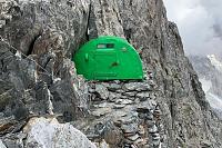
(2590 m a.s.l., 2.3 km)
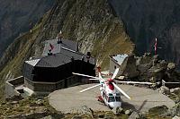
(3071 m a.s.l., 2.5 km)
(4362 m a.s.l., 2.9 km)
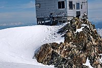
(2325 m a.s.l., 3.6 km)
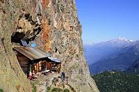
(3675 m a.s.l., 4 km)
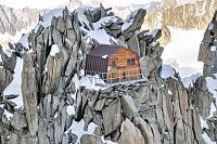
(3150 m a.s.l., 4 km)
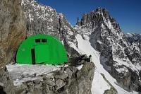
(3358 m a.s.l., 4.2 km)
(3835 m a.s.l., 4.8 km)
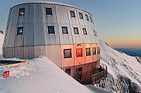
(3167 m a.s.l., 5.7 km)
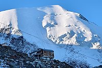
(3051 m a.s.l., 5.8 km)
Webcams
( 2.9 km)
 Courmayeur › North-East: Vallot Hut - Refuge du Goûter(3815m)
(4351 m a.s.l., 2.9 km)
 Saint-Gervais-les-Bains: Refuge du Goûter(3815m) - Mont Blanc
(3771 m a.s.l., 4.5 km)
 Saint-Gervais-les-Bains: Refuge du Goûter(3815m) - Mont Blanc
(3765 m a.s.l., 4.7 km)
 Saint-Gervais-les-Bains: Refuge du Goûter(3815m) - Mont Blanc
(3825 m a.s.l., 4.8 km)
 Saint-Gervais-les-Bains › East: Refuge du Goûter(3815m) - Grand couloir
(3787 m a.s.l., 5 km)
 Saint-Gervais-les-Bains: Refuge du Goûter(3815m) - Mont Blanc
(3650 m a.s.l., 5.1 km)
 Saint-Gervais-les-Bains › North: Tête Rousse Hut
(3123 m a.s.l., 5.7 km)
 Saint-Gervais-les-Bains › South-East: Mont Blanc
(3104 m a.s.l., 5.7 km)
 Courmayeur: Col Checrouit
(2263 m a.s.l., 5.8 km)
 Courmayeur: Colle Checrouit, Pista Checrouit
( 5.8 km)
 Courmayeur: Youla
(2635 m a.s.l., 5.9 km)

Sun
| today | tomorrow | day after tomorrow | |
|---|---|---|---|
| Dawn: | 7:28 | 7:29 | 7:31 |
| Sunrise: | 7:58 | 8:00 | 8:01 |
| Sunset: | 18:35 | 18:33 | 18:31 |
| Dusk: | 19:05 | 19:03 | 19:02 |