



Hiking
1998
 Francie
 Itálie
Logged on Vrcholovka 1x in total. Vrchol Aiguille de Rochefort was added here by Milan "Hojší" Průžek and info was completed by Milan "Hojší" Průžek.
Aiguille de Rochefort is part of challenges: 24 quatre-mille français, 39 quattromila italiani, Alpine Four-thousanders
All climbers from beginners to experienced guides agree that this ridge is truly worth it. Moreover, it offers the opportunity to add two more four-thousanders to the list of ascents. Most teams on the Rochefort Ridge are satisfied with the ascent to Aiguille de Rochefort (4,001 m), from where they return. The highest point of this group, Dôme de Rochefort (4,015 m), is located a bit further east and is rarely climbed. Usually, it is ascended by teams that have set out to traverse the entire ridge to the Canzio bivouac. The first, almost horizontal section from a place called Frühstückplatz is technically easy. The approach to Aiguille de Rochefort (up to III) may require a bit more attention.
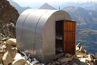
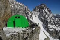
However, the overall traverse, during which climbers are constantly at an altitude above 4,000 meters, requires both attention and concentration, as well as acclimatization. The traverse itself is a beautiful hike and is worth it even for those who do not continue further over the Grandes Jorasses. The adventure culminates with a hike to the bivouac, and a night in the cozy "garbage can" at the foot of Pointe Jones is a special experience. Additionally, it is a good starting point for the morning descent before the Mont Mallet glacier, which is considered one of the most crevassed in the entire Mont Blanc massif. It is recommended to cross it as early as possible while the snow bridges are still solid.
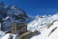
The normal route to the summit leads from the Italian hut and cable car Rifugio Torino (3,322 and 3,375 m, 2 buildings) at the Col du Géant saddle, around the Dent du Géant peak, and further along the eastern ridge to the summit. The descent is possible to the Canzio bivouac at the Col des Grandes Jorasses saddle and into the Val Ferret valley on the Italian side of the massif. The overall climbing difficulty of the hike is AD. The ascent and descent take two days of climbing, hiking, and rappelling.
The mountain was first ascended on August 14, 1873, by J. Eccles, M.-C. Payot, and A. Payot.
There is no chalet on the peak.
Peak is not stroller accessible.
There are views from the peak.
There is no cable car to this peak.
Special equipment is required for this summit.
Peak is freely accessible.
Nearest peaks: Dente del Gigante / Dent du Géant (4013 m, 0.6 km) Dôme de Rochefort (4015 m, 0.6 km) Grandes Jorasses / Punta Margherita (4065 m, 1.6 km) Grandes Jorasses / Punta Elena (4045 m, 1.7 km) Aiguilles Marbrées (3535 m, 1.9 km) Grandes Jorasses / Pointe Croz (4110 m, 1.9 km) Grandes Jorasses / Pointe Whymper (4184 m, 2.1 km) Grandes Jorasses / Pointe Walker (4208 m, 2.3 km) Pointe Helbronner (3462 m, 2.8 km)
 Alpský výstup na Pyramide du Tacul východní hranou
 Výstup na Arete des Cosmiques na Aiguille du Midi
 Okružní výstup na vrchol Tete de la Tronche naproti Mont Blancu
Výstup na nejvyšší vrchol Evropy normálkou - Mont Blanc
 Túra pro fotografy za vyhlídkou Le Signal Forbes
Letní Haute Route: přechod Alp z Chamonix do Zermattu
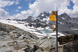 Trek k bílé perle Alp - Mont Blanc
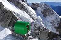
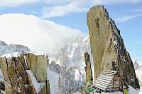

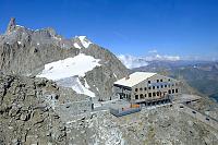
 Casa Purtud: Punta Helbronner
 Chamonix-Mont-Blanc
 Chamonix-Mont-Blanc › South-East
 Courmayeur: Valle d’Aosta, Italia: Monte Bianco
 Entrèves: Cantiere nuova funivia del monte bianco
 Chamonix-Mont-Blanc › North-East: Aiguille du Tacul - Grandes Jorasses
 Chamonix-Mont-Blanc: Aiguille du Tacul - Grandes Jorasses
 Chamonix-Mont-Blanc › North-East: Argentière Hut
 Chamonix-Mont-Blanc
 Chamonix-Mont-Blanc › South-East: Aiguille du Tacul - Grandes Jorasses

| today | tomorrow | day after tomorrow | |
|---|---|---|---|
| Dawn: | 6:42 | 6:44 | 6:45 |
| Sunrise: | 7:13 | 7:15 | 7:16 |
| Sunset: | 17:17 | 17:16 | 17:14 |
| Dusk: | 17:48 | 17:47 | 17:46 |