Grandes Jorasses / Pointe Whymper (4184 m a.s.l., Mont Blanc)
Register and log summit


About peak Grandes Jorasses / Pointe Whymper
 Francie
 Itálie
Vrchol Grandes Jorasses / Pointe Whymper was added here by Milan "Hojší" Průžek and info was completed by Milan "Hojší" Průžek a Martin Matějka.
Grandes Jorasses / Pointe Whymper is part of challenges: 24 quatre-mille français, 39 quattromila italiani, Alpine Four-thousanders
The Grandes Jorasses ridge runs from the Col des Hirondelles pass (3491 m) in the east to the Col des Grandes Jorasses pass (3870 m) in the west. To the west of the Col des Grandes Jorasses pass lies the Rochefort ridge.
Grandes Jorasses has the following peaks (from east to west):
Pointe Walker (4208 m) - the highest peak, the end of the Hirondelles ridge
Pointe Whymper (4104 m)
Pointe Croz (4110 m)
Pointe Helene (4045 m)
Pointe Margarita (4065 m)
Pointe Young (3996 m)
The north face of Grandes Jorasses above the Glacier de Leschaux is 1200 m high. The classic route from this side is the Walker Pillar (Cassin/Esposito/Tizzoni, 1938, TD+/ED1, IV, 5c/6a, A1, 1200 m).
The Walker Pillar on Grandes Jorasses, the north face of the Eiger, and the north face of the Matterhorn form the so-called "Alpine triptych" (the most challenging faces of the Alps).
The first ascent was made on June 30, 1868, by Horace Walker, Melchior Anderegg, Johann Jaun, and Julien Grange.
- Chalet/accommodation
-
There is no chalet on the peak.
- Stroller access
-
Peak is not stroller accessible.
- Views
-
There are views from the peak.
- Cable car
-
There is no cable car to this peak.
- Equipment
-
Special equipment is required for this summit.
- Accessibility
Nearest peaks: Grandes Jorasses / Pointe Croz (4110 m, 0.2 km) Grandes Jorasses / Pointe Walker (4208 m, 0.3 km) Grandes Jorasses / Punta Elena (4045 m, 0.4 km) Grandes Jorasses / Punta Margherita (4065 m, 0.6 km) Dôme de Rochefort (4015 m, 1.4 km) Aiguille de Rochefort (4001 m, 2.1 km) Aiguille de Leschaux (3759 m, 2.7 km)
Routes nearby
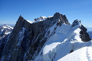 Alpský výstup na Pyramide du Tacul východní hranou
(elevation gain 700 m, 10 km)
 Výstup na Arete des Cosmiques na Aiguille du Midi
(elevation gain 400 m, )
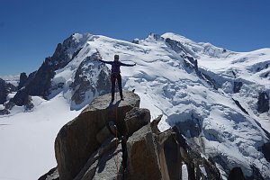 Okružní výstup na vrchol Tete de la Tronche naproti Mont Blancu
(elevation gain 1900 m, 25 km)
Túra pro fotografy za vyhlídkou Le Signal Forbes(elevation gain 300 m, 6 km)
Mountain chalets
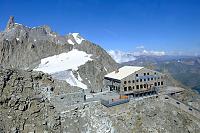
(3818 m a.s.l., 0.8 km)
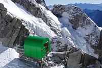
(3264 m a.s.l., 1.5 km)
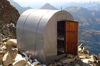
(2803 m a.s.l., 1.8 km)

(3400 m a.s.l., 2 km)
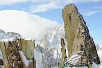
(2835 m a.s.l., 2.3 km)
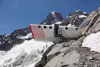
(2447 m a.s.l., 2.9 km)
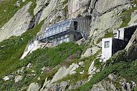
(2516 m a.s.l., 4.6 km)
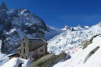
(3375 m a.s.l., 4.7 km)
Webcams
(1642 m a.s.l., 3.5 km)
 Chamonix-Mont-Blanc
( 4.6 km)
 Chamonix-Mont-Blanc
( 4.8 km)
 Courmayeur: Pointe Helbronner
(3387 m a.s.l., 4.8 km)
 Casa Purtud: Punta Helbronner
(3403 m a.s.l., 4.8 km)
 Chamonix-Mont-Blanc › North-East: Aiguille du Tacul - Grandes Jorasses
(-32768 m a.s.l., 4.9 km)
 Chamonix-Mont-Blanc: Aiguille du Tacul - Grandes Jorasses
(-32768 m a.s.l., 4.9 km)
 Chamonix-Mont-Blanc › North-East: Argentière Hut
(-32768 m a.s.l., 4.9 km)
 Chamonix-Mont-Blanc › South-East: Aiguille du Tacul - Grandes Jorasses
(-32768 m a.s.l., 4.9 km)
 Chamonix-Mont-Blanc › South-East
( 4.9 km)
 Courmayeur: Valle d’Aosta, Italia: Monte Bianco
(2159 m a.s.l., 5.2 km)
 Entrèves: Cantiere nuova funivia del monte bianco
(1345 m a.s.l., 6.2 km)

Sun
| today | tomorrow | day after tomorrow | |
|---|---|---|---|
| Dawn: | 6:43 | 6:45 | 6:46 |
| Sunrise: | 7:15 | 7:16 | 7:17 |
| Sunset: | 17:16 | 17:14 | 17:13 |
| Dusk: | 17:47 | 17:45 | 17:44 |