Grandes Jorasses / Punta Margherita (4065 m a.s.l., Mont Blanc)
Register and log summit


About peak Grandes Jorasses / Punta Margherita
Francie Itálie
Vrchol Grandes Jorasses / Punta Margherita was added here by Milan "Hojší" Průžek and info was completed by Milan "Hojší" Průžek a Martin Matějka.
Grandes Jorasses / Punta Margherita is part of challenges: 24 quatre-mille français, 39 quattromila italiani, Alpine Four-thousanders
The Grandes Jorasses are one of the most famous peaks in the Alps. The mountain, located on the eastern side of the Mont Blanc massif, is actually a massive wall over a kilometer long, forming one of the most impressive granite formations in the entire Alps, culminating at Pointe Walker at an elevation of 4208 m. The Grandes Jorasses are not a classic or pyramid-shaped peak like the Drus. The summit ridge consists of six pinnacles, separated by a series of deep notches. From west to east, these are Pointe Young, Punta Margherita, Punta Elena, Pointe Croz, Pointe Whymper, and Pointe Walker. The massif extends east-west, ending in the east at the Hirondelles Pass (3480 m) and in the west at the Grandes Jorasses Pass.
The Grandes Jorasses massif has 6 peaks:
- Punta (Pointe) Walker (4,206 m)
- Punta (Pointe) Whymper (4,180 m)
- Punta (Pointe) Croz (4,108 m)
- Punta Margherita (Pointe Marguerite) (4,065 m)
- Punta Elena (Pointe Hélène) (4,045 m)
- Pointe Young (3,996 m)
- Chalet/accommodation
-
There is no chalet on the peak.
- Stroller access
-
Peak is not stroller accessible.
- Views
-
There are views from the peak.
- Cable car
-
There is no cable car to this peak.
- Equipment
-
Special equipment is required for this summit.
- Accessibility
Nearest peaks: Grandes Jorasses / Punta Elena (4045 m, 0.1 km) Grandes Jorasses / Pointe Croz (4110 m, 0.3 km) Grandes Jorasses / Pointe Whymper (4184 m, 0.6 km) Dôme de Rochefort (4015 m, 0.9 km) Grandes Jorasses / Pointe Walker (4208 m, 0.9 km) Aiguille de Rochefort (4001 m, 1.6 km) Dente del Gigante / Dent du Géant (4013 m, 2.1 km) Aiguille de Leschaux (3759 m, 3 km)
Routes nearby
 Alpský výstup na Pyramide du Tacul východní hranou
(elevation gain 700 m, 10 km)
 Výstup na Arete des Cosmiques na Aiguille du Midi
(elevation gain 400 m, )
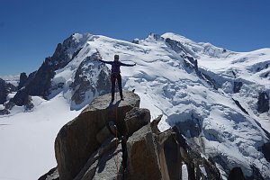 Okružní výstup na vrchol Tete de la Tronche naproti Mont Blancu
(elevation gain 1900 m, 25 km)
Túra pro fotografy za vyhlídkou Le Signal Forbes(elevation gain 300 m, 6 km)
Mountain chalets
(3818 m a.s.l., 0.3 km)

(3400 m a.s.l., 1.5 km)
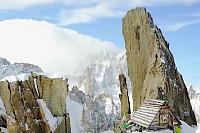
(2803 m a.s.l., 1.7 km)

(3264 m a.s.l., 2 km)
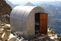
(2835 m a.s.l., 2.8 km)

(2447 m a.s.l., 2.9 km)
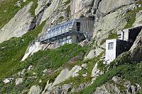
(2516 m a.s.l., 4.1 km)
(3375 m a.s.l., 4.3 km)
Webcams
(1642 m a.s.l., 4 km)
 Chamonix-Mont-Blanc
( 4.1 km)
 Courmayeur: Pointe Helbronner
(3387 m a.s.l., 4.4 km)
 Casa Purtud: Punta Helbronner
(3403 m a.s.l., 4.4 km)
 Chamonix-Mont-Blanc › South-East
( 4.4 km)
 Chamonix-Mont-Blanc
( 4.7 km)
 Chamonix-Mont-Blanc › South-East: Aiguille du Tacul - Grandes Jorasses
(-32768 m a.s.l., 4.7 km)
 Chamonix-Mont-Blanc › North-East: Aiguille du Tacul - Grandes Jorasses
(-32768 m a.s.l., 4.8 km)
 Chamonix-Mont-Blanc: Aiguille du Tacul - Grandes Jorasses
(-32768 m a.s.l., 4.8 km)
 Chamonix-Mont-Blanc › North-East: Argentière Hut
(-32768 m a.s.l., 4.8 km)
 Courmayeur: Valle d’Aosta, Italia: Monte Bianco
(2159 m a.s.l., 4.9 km)
 Entrèves: Cantiere nuova funivia del monte bianco
(1345 m a.s.l., 6 km)

Sun
| today | tomorrow | day after tomorrow | |
|---|---|---|---|
| Dawn: | 6:59 | 7:01 | 7:02 |
| Sunrise: | 7:32 | 7:33 | 7:34 |
| Sunset: | 17:01 | 17:00 | 16:59 |
| Dusk: | 17:33 | 17:32 | 17:31 |