Aiguilles du Diable - Pointe Carmen (4109 m a.s.l., Mont Blanc)
Register and log summit


About peak Aiguilles du Diable - Pointe Carmen
 Francie
Vrchol Aiguilles du Diable - Pointe Carmen was added here by Milan "Hojší" Průžek and info was completed by Milan "Hojší" Průžek a Martin Matějka.
Aiguilles du Diable - Pointe Carmen is part of challenges: 24 quatre-mille français, Alpine Four-thousanders
Located between Aiguille du Midi and Mont Blanc. The summit can be reached from Refuge Les Cosmiques (3613 m) on the French side and from Rifugio Torino (3322 m and 3375 m, 2 buildings) on the Italian side.
The first ascent was made on August 8, 1855, by Charles Hudson, Edward John Stevenson, Christopher, James Grenville Smith, E. S. Kennedy, Charles Ainslie, and G. C. Joad.
The ascent of Mont Blanc du Tacul is part of a popular climbing route from the Midi pass, which continues over Mont Maudit to Mont Blanc. It is the hardest of the four so-called normal routes to the highest mountain in Europe.
Below the eastern cliffs above the Vallée Blanche glacier stands a group of granite rock towers collectively known as the Satellites of Tacul, which are a popular climbing destination: Grand Capucin (3838 m), Petit Capucin (3693 m), Pointe Lachenal (3613 m), Gros Rognon (3541 m), Pointe Adolphe Rey (3536 m), Chat (3500 m), Clocher (3853 m), Trident (3639 m), Pyramide du Tacul (3468 m), and Chandelle du Tacul (3561 m).
- Chalet/accommodation
-
There is no chalet on the peak.
- Stroller access
-
Peak is not stroller accessible.
- Views
-
There are views from the peak.
- Cable car
-
There is no cable car to this peak.
- Equipment
-
Special equipment is required for this summit.
- Accessibility
Nearest peaks: Aiguilles du Diable - Pointe Médiane (4097 m, 0 km) Aiguilles du Diable - Corne du Diable (4064 m, 0.1 km) Aiguilles du Diable - L'Isolée (4114 m, 0.1 km) Aiguilles du Diable - Pointe Chaubert (4074 m, 0.1 km) Mont Blanc du Tacul (4248 m, 0.3 km) Mont Maudit (4465 m, 1.5 km) Aiguille du Midi (3842 m, 2.7 km) Grand Pilier d'Angle (4243 m, 3.1 km) Mont Blanc (4810 m, 3.2 km) Mont Blanc de Courmayeur (4748 m, 3.4 km)
Routes nearby
(elevation gain 700 m, 10 km)
 Výstup na Arete des Cosmiques na Aiguille du Midi
(elevation gain 400 m, )
 Výstup na nejvyšší vrchol Evropy normálkou - Mont Blanc
(elevation gain 2700 m, 17 km)
 Z Itálie na vrchol Evropy - Monte Bianco neboli Mont Blanc
(elevation gain 3600 m, 35 km)
Túra za vyhlídkou a nocovištěm prvních dobyvatelů Mont Blancu(elevation gain 1900 m, 14 km)
Přechod Grandes Jorasses: VHT túra snů Letní Haute Route: přechod Alp z Chamonix do Zermattu
(elevation gain 13000 m, 180 km)
 Trek k bílé perle Alp - Mont Blanc
(elevation gain 1800 m, 20 km)
Okružní výstup na vrchol Tete de la Tronche naproti Mont Blancu(elevation gain 1900 m, 25 km)
Túra pro fotografy za vyhlídkou Le Signal Forbes(elevation gain 300 m, 6 km)
Mountain chalets
(3675 m a.s.l., 1.1 km)
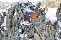
(3613 m a.s.l., 2.3 km)
(3150 m a.s.l., 2.4 km)
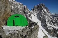
(3051 m a.s.l., 2.7 km)
(3375 m a.s.l., 3.4 km)
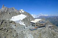
(4362 m a.s.l., 3.5 km)
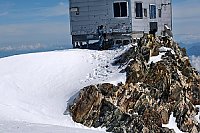
(3490 m a.s.l., 4 km)
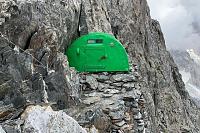
(3860 m a.s.l., 4.1 km)
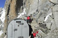
(2516 m a.s.l., 4.5 km)
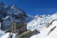
(2325 m a.s.l., 5.4 km)
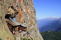
(2207 m a.s.l., 5.7 km)
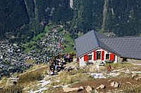
(3071 m a.s.l., 6 km)
(2590 m a.s.l., 6.1 km)
Webcams
(3662 m a.s.l., 2.7 km)
 Mont-Blanc from Aiguille du Midi
(3667 m a.s.l., 2.7 km)
 Chamonix: Mont Blanc Aiuguille du Midi
(3609 m a.s.l., 2.7 km)
 Les Bossons: From Aiguille du Midi (3.800 mts) looking to East
(3693 m a.s.l., 2.8 km)
 Chamonix: Mont-Blanc - Aiguille du Midi panomax-hd
(-32768 m a.s.l., 2.8 km)
 Chamonix: Mont-Blanc - Aguille du Midi
(-32768 m a.s.l., 2.9 km)
 Casa Purtud: Punta Helbronner
(3403 m a.s.l., 3.2 km)
 Courmayeur: Pointe Helbronner
(3387 m a.s.l., 3.3 km)
 Chamonix-Mont-Blanc
( 3.5 km)
 Courmayeur › North-East: Vallot Hut - Refuge du Goûter(3815m)
(4351 m a.s.l., 3.5 km)
 Chamonix-Mont-Blanc › South-East
( 4.2 km)
 Saint-Gervais-les-Bains: Refuge du Goûter(3815m) - Mont Blanc
(3771 m a.s.l., 4.6 km)
 Chamonix-Mont-Blanc
( 4.6 km)
 Courmayeur: Valle d’Aosta, Italia: Monte Bianco
(2159 m a.s.l., 5.2 km)
 Chamonix: Mont-Blanc
(2233 m a.s.l., 5.3 km)

Sun
| today | tomorrow | day after tomorrow | |
|---|---|---|---|
| Dawn: | 6:41 | 6:43 | 6:44 |
| Sunrise: | 7:12 | 7:14 | 7:15 |
| Sunset: | 17:19 | 17:17 | 17:16 |
| Dusk: | 17:50 | 17:48 | 17:47 |