Aiguilles du Diable - Pointe Médiane (4097 m a.s.l., Mont Blanc)
Register and log summit


About peak Aiguilles du Diable - Pointe Médiane
Francie
Vrchol Aiguilles du Diable - Pointe Médiane was added here by Milan "Hojší" Průžek and info was completed by Milan "Hojší" Průžek a Martin Matějka.
Aiguilles du Diable - Pointe Médiane is part of challenges: 24 quatre-mille français, Alpine Four-thousanders
Above the eastern face of Mont Blanc du Tacul, its large pillars rise to the sky like five fingers of a hand, the five peaks of Aiguilles du Diable. They are very photogenic and jagged like hell itself. That is why they are named Aiguilles du Diable - Devil's Needles. They belong to the list of four-thousanders more for historical than topographical reasons. The prominence of each does not exceed 100 m. Each needle boasts its own name, from the east they are:
- L'Isolée (Pointe Blanchet) (4,114 m)
- Pointe Carmen (4,109 m)
- Pointe Médiane (4,097 m)
- Pointe Chaubert (4,074 m)
- Corne du Diable (4,064 m)
- Chalet/accommodation
-
There is no chalet on the peak.
- Stroller access
-
Peak is not stroller accessible.
- Views
-
There are views from the peak.
- Cable car
-
There is no cable car to this peak.
- Equipment
-
Special equipment is required for this summit.
- Accessibility
Nearest peaks: Aiguilles du Diable - Pointe Carmen (4109 m, 0 km) Aiguilles du Diable - Corne du Diable (4064 m, 0.1 km) Aiguilles du Diable - L'Isolée (4114 m, 0.1 km) Aiguilles du Diable - Pointe Chaubert (4074 m, 0.1 km) Mont Blanc du Tacul (4248 m, 0.4 km) Mont Maudit (4465 m, 1.5 km) Aiguille du Midi (3842 m, 2.7 km) Grand Pilier d'Angle (4243 m, 3.1 km) Mont Blanc (4810 m, 3.2 km) Mont Blanc de Courmayeur (4748 m, 3.4 km)
Routes nearby
(elevation gain 700 m, 10 km)
 Výstup na Arete des Cosmiques na Aiguille du Midi
(elevation gain 400 m, )
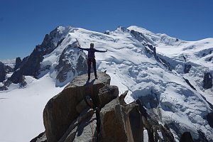 Výstup na nejvyšší vrchol Evropy normálkou - Mont Blanc
(elevation gain 2700 m, 17 km)
 Z Itálie na vrchol Evropy - Monte Bianco neboli Mont Blanc
(elevation gain 3600 m, 35 km)
Túra za vyhlídkou a nocovištěm prvních dobyvatelů Mont Blancu(elevation gain 1900 m, 14 km)
Přechod Grandes Jorasses: VHT túra snů Letní Haute Route: přechod Alp z Chamonix do Zermattu
(elevation gain 13000 m, 180 km)
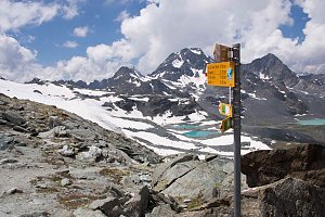 Okružní výstup na vrchol Tete de la Tronche naproti Mont Blancu
(elevation gain 1900 m, 25 km)
Trek k bílé perle Alp - Mont Blanc(elevation gain 1800 m, 20 km)
Túra pro fotografy za vyhlídkou Le Signal Forbes(elevation gain 300 m, 6 km)
Mountain chalets
(3675 m a.s.l., 1.1 km)
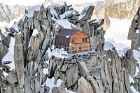
(3150 m a.s.l., 2.4 km)
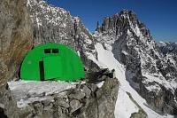
(3613 m a.s.l., 2.4 km)
(3051 m a.s.l., 2.7 km)
(3375 m a.s.l., 3.4 km)
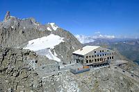
(4362 m a.s.l., 3.5 km)
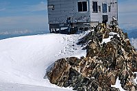
(3490 m a.s.l., 4 km)

(3860 m a.s.l., 4.1 km)

(2516 m a.s.l., 4.4 km)
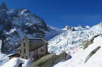
(2325 m a.s.l., 5.4 km)
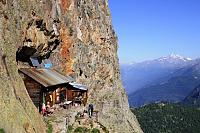
(2207 m a.s.l., 5.7 km)
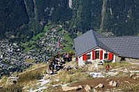
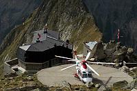
(3071 m a.s.l., 6.1 km)
(2590 m a.s.l., 6.1 km)
Webcams
(3662 m a.s.l., 2.7 km)
 Mont-Blanc from Aiguille du Midi
(3667 m a.s.l., 2.7 km)
 Chamonix: Mont Blanc Aiuguille du Midi
(3609 m a.s.l., 2.7 km)
 Les Bossons: From Aiguille du Midi (3.800 mts) looking to East
(3693 m a.s.l., 2.8 km)
 Chamonix: Mont-Blanc - Aiguille du Midi panomax-hd
(-32768 m a.s.l., 2.8 km)
 Chamonix: Mont-Blanc - Aguille du Midi
(-32768 m a.s.l., 2.9 km)
 Courmayeur: Pointe Helbronner
(3387 m a.s.l., 3.2 km)
 Casa Purtud: Punta Helbronner
(3403 m a.s.l., 3.2 km)
 Chamonix-Mont-Blanc
( 3.5 km)
 Courmayeur › North-East: Vallot Hut - Refuge du Goûter(3815m)
(4351 m a.s.l., 3.5 km)
 Chamonix-Mont-Blanc › South-East
( 4.1 km)
 Chamonix-Mont-Blanc
( 4.6 km)
 Saint-Gervais-les-Bains: Refuge du Goûter(3815m) - Mont Blanc
(3771 m a.s.l., 4.7 km)
 Courmayeur: Valle d’Aosta, Italia: Monte Bianco
(2159 m a.s.l., 5.2 km)
 Chamonix: Mont-Blanc
(2233 m a.s.l., 5.3 km)

Sun
| today | tomorrow | day after tomorrow | |
|---|---|---|---|
| Dawn: | 6:53 | 6:54 | 6:56 |
| Sunrise: | 7:25 | 7:26 | 7:28 |
| Sunset: | 17:07 | 17:06 | 17:04 |
| Dusk: | 17:39 | 17:37 | 17:36 |