Hiking, 17 km
30.1.2026
 Česko
Prachatice (Jihočeský kraj)
Logged on Vrcholovka 10x in total. Peak information here was completed by Bouřka a Vladimír Grančay.
Ptačí skály is part of challenge: Šumavské tisícovky
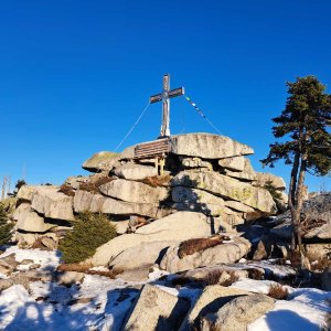
The peak is located about 1200 m northwest of the thousand-meter summit Nad Rakouskou loukou, on its sloping ridge defined by the gorges of Stocký potok and Světlá. It is a prominent solitary rock formation with dense horizontal layering. The saddle is the terrain near the rock, with an elevation gain of about 10 meters. The rock is relatively difficult to climb. (tisicovky.cz)
There is no chalet on the peak.
Peak is not stroller accessible.
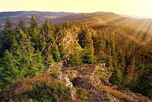
There are views from the peak.
There is no cable car to this peak.
No special equipment is required for this summit.
Peak is freely accessible.
Nearest peaks: Plechý S2 (1336 m, 1.1 km) Jakubova chýše (1157 m, 1.2 km) Plechý S (1337 m, 1.2 km) Trojmezná (1362 m, 1.2 km) Nad Rakouskou loukou (1378 m, 1.3 km) Plechý (1378 m, 1.6 km) V Pařezí J2 (1129 m, 1.8 km) V Pařezí J (1140 m, 1.9 km) Vysoký hřeben (1341 m, 1.9 km) V Pařezí (1157 m, 2.2 km) Jakubova chýše SSZ (995 m, 2.5 km) Plöckenstein J (1275 m, 2.5 km) Teufelsschüssel (1108 m, 2.6 km) Fegefeuer-Hexentanz (1085 m, 2.7 km) In Pařezí S (1101 m, 2.7 km) Jakubova chýše SZ (989 m, 2.8 km) Buchenwald (1214 m, 2.9 km) V růžku (1095 m, 2.9 km) At Pařezí V (947 m, 3.1 km) Plöckenstein JV (1228 m, 3.2 km) Plešivec Z (939 m, 3.7 km)
 Přechod NP Šumava
 Schwarzenberg am Bohmerwald: Schwarzenbergbahn Talstation
 Klaffer am Hochficht: Hochficht Böhmerwald - Reischlberg Mittelstation
 Klaffer am Hochficht: Hochficht Böhmerwald - Reischlberg Mittelstation
 Klaffer am Hochficht: Hochficht Böhmerwald - Reischlberg Mittelstation
 Stozec › South-West: Nové Údolí
 Stozec › South-West

| today | tomorrow | day after tomorrow | |
|---|---|---|---|
| Dawn: | 6:11 | 6:12 | 6:13 |
| Sunrise: | 6:43 | 6:45 | 6:46 |
| Sunset: | 16:53 | 16:51 | 16:50 |
| Dusk: | 17:26 | 17:24 | 17:22 |