Gailtal Alps
| Highest peak | Grosse Sandspitze (2772 m a.s.l.) |
|---|---|
| Most prominent peak | Reißkofel (2371 m a.s.l., prominence 1391 m) |
| Parent unit | Southern Limestone Alps |
| Sub-units | Lienzské Dolomity |
| Main peaks | Total 74 |
| Most popular peaks | Goldeck (2142 m a.s.l.), Kleine Laserzwand (2568 m a.s.l.), Grosse Sandspitze (2772 m a.s.l.), Dobratsch (2166 m a.s.l.), Grosse Gamswiesenspitze (2486 m a.s.l.) |
| Mountain range challenges | Austrian Alps, King of the Gailtal Alps, Vápencové ultraperly východních Alp |

| Name | Elevation | ||||
|---|---|---|---|---|---|

|
Grosse Sandspitze | 2772 m a.s.l. | Lienzské Dolomity | 1245 m | hlavní vrchol |

|
Kleine Sandspitze | 2761 m a.s.l. | Lienzské Dolomity | 44 m | hlavní vrchol |

|
Seekofel | 2738 m a.s.l. | Lienzské Dolomity | 121 m | hlavní vrchol |
|
|
Daumen | 2720 m a.s.l. | Lienzské Dolomity | 35 m | hlavní vrchol |

|
Grosser Laserzkopf | 2718 m a.s.l. | Lienzské Dolomity | 73 m | hlavní vrchol |
|
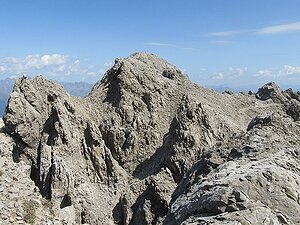
Spitzkofel | 2717 m a.s.l. | Lienzské Dolomity | 463 m | hlavní vrchol |

|
Grosser Galizenspitze | 2710 m a.s.l. | Lienzské Dolomity | 55 m | hlavní vrchol |

|
Simonskopf | 2685 m a.s.l. | Lienzské Dolomity | 104 m | hlavní vrchol |
|
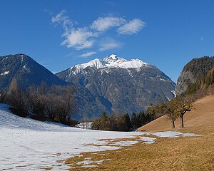
Hochstadel | 2681 m a.s.l. | Lienzské Dolomity | 335 m | hlavní vrchol |

|
Schneeklammkopf | 2642 m a.s.l. | Lienzské Dolomity | 47 m | hlavní vrchol |

|
Schöttnerspitze | 2617 m a.s.l. | Lienzské Dolomity | 32 m | hlavní vrchol |

|
Laserzwand | 2614 m a.s.l. | Lienzské Dolomity | 10 m | vedlejší vrchol |
|
|
Teplitzer Spitze | 2609 m a.s.l. | Lienzské Dolomity | 38 m | hlavní vrchol |
|
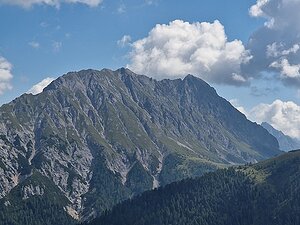
Eggenkofel | 2591 m a.s.l. | Lienzské Dolomity | 719 m | hlavní vrchol |
|
|
Kleine Laserzwand | 2568 m a.s.l. | Lienzské Dolomity | 28 m | hlavní vrchol |
|
|
Weittalspitze | 2538 m a.s.l. | Lienzské Dolomity | 201 m | hlavní vrchol |
|
|
Grosse Gamswiesenspitze | 2486 m a.s.l. | Lienzské Dolomity | 201 m | hlavní vrchol |

|
Kleine Gamswiesenspitze | 2454 m a.s.l. | Lienzské Dolomity | 81 m | hlavní vrchol |

|
Riebenkofel | 2386 m a.s.l. | Lienzské Dolomity | 113 m | hlavní vrchol |
|
|
Tamerlanhöhe | 2376 m a.s.l. | Lienzské Dolomity | 80 m | hlavní vrchol |

|
Reißkofel | 2371 m a.s.l. | Gailtal Alps | 1391 m | hlavní vrchol |
|
|
Golzentipp | 2317 m a.s.l. | Lienzské Dolomity | 364 m | hlavní vrchol |
|
|
Alplspitze | 2296 m a.s.l. | Lienzské Dolomity | 71 m | hlavní vrchol |
|
|
Lumkofel | 2286 m a.s.l. | Lienzské Dolomity | 345 m | hlavní vrchol |
|
|
Rudnigkogel | 2283 m a.s.l. | Lienzské Dolomity | 18 m | hlavní vrchol |
|
|
Torkofel | 2276 m a.s.l. | Gailtal Alps | 665 m | hlavní vrchol |
|
|
Spitzenstein | 2274 m a.s.l. | Lienzské Dolomity | 161 m | hlavní vrchol |
|
|
Pfanegg | 2248 m a.s.l. | Lienzské Dolomity | 70 m | hlavní vrchol |
|
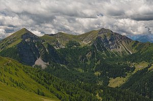
Latschur | 2236 m a.s.l. | Gailtal Alps | 1278 m | hlavní vrchol |
|
|
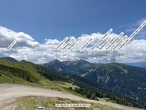
Jaukenhöhe | 2234 m a.s.l. | Gailtal Alps | 129 m | hlavní vrchol |
|
Eckwand | 2221 m a.s.l. | Gailtal Alps | 113 m | hlavní vrchol |
|
|
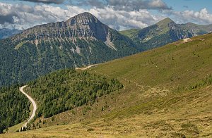
Soleck | 2221 m a.s.l. | Lienzské Dolomity | 66 m | hlavní vrchol |
|
Staff | 2217 m a.s.l. | Gailtal Alps | 235 m | hlavní vrchol |
|
|
Jaukenstöckel | 2204 m a.s.l. | Gailtal Alps | 34 m | hlavní vrchol |
|
|
Kofelspitz | 2185 m a.s.l. | Lienzské Dolomity | 80 m | hlavní vrchol |
|
|
Steinrastl | 2184 m a.s.l. | Lienzské Dolomity | 95 m | hlavní vrchol |
|
|
Almspitz | 2180 m a.s.l. | Gailtal Alps | 45 m | hlavní vrchol |

|
Dobratsch | 2166 m a.s.l. | Gailtal Alps | 1239 m | hlavní vrchol |
|
|
Kleiner Reißkofel | 2163 m a.s.l. | Gailtal Alps | 139 m | hlavní vrchol |

|
Goldeck | 2142 m a.s.l. | Gailtal Alps | 418 m | hlavní vrchol |
|
|
Kämpen | 2142 m a.s.l. | Gailtal Alps | 14 m | vedlejší vrchol |

|
Seetalnock | 2130 m a.s.l. | Gailtal Alps | 54 m | hlavní vrchol |
|
|
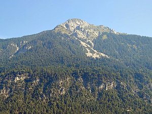
Millnatzenkofel | 2128 m a.s.l. | Lienzské Dolomity | 23 m | hlavní vrchol |
|
Spitzegel | 2119 m a.s.l. | Gailtal Alps | 1046 m | hlavní vrchol |
|
|
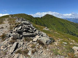
Dorfberg | 2115 m a.s.l. | Lienzské Dolomity | 76 m | hlavní vrchol |
|
Fuchsnock | 2112 m a.s.l. | Gailtal Alps | 27 m | hlavní vrchol |
|
|
Vellacher Egel | 2108 m a.s.l. | Gailtal Alps | 137 m | hlavní vrchol |
|
|
Politzen | 2104 m a.s.l. | Lienzské Dolomity | 9 m | vedlejší vrchol |
|
|
Schatzbichl | 2090 m a.s.l. | Lienzské Dolomity | 539 m | hlavní vrchol |
|
|
Kopasnock | 2087 m a.s.l. | Gailtal Alps | 22 m | hlavní vrchol |
|
|
Böse Gräben | 2076 m a.s.l. | Gailtal Alps | 6 m | vedlejší vrchol |
|
|
Böse Gräben | 2076 m a.s.l. | Gailtal Alps | 6 m | vedlejší vrchol |
|
|
Grünnock | 2067 m a.s.l. | Gailtal Alps | 21 m | hlavní vrchol |
|
|
Kreuzbühel | 2060 m a.s.l. | Gailtal Alps | 75 m | hlavní vrchol |
|
|
Zwölfernock | 2049 m a.s.l. | Gailtal Alps | 55 m | hlavní vrchol |
|
|
Kuhstand | 2046 m a.s.l. | Gailtal Alps | 61 m | hlavní vrchol |
|
|
Graslitzen | 2044 m a.s.l. | Gailtal Alps | 205 m | hlavní vrchol |
|
|
Mussenhöhe | 2040 m a.s.l. | Lienzské Dolomity | 85 m | hlavní vrchol |
|
|
Martennock | 2039 m a.s.l. | Gailtal Alps | 18 m | hlavní vrchol |
|
|
Sattelnock | 2033 m a.s.l. | Gailtal Alps | 58 m | hlavní vrchol |
|
|
Elfernock | 2031 m a.s.l. | Gailtal Alps | 17 m | hlavní vrchol |
|
Auerlingköpfl | 2026 m a.s.l. | Lienzské Dolomity | 7 m | vedlejší vrchol |
|
|
Kleiner Grünnock | 2022 m a.s.l. | Gailtal Alps | 5 m | vedlejší vrchol |
|
|
Genitzen | 2012 m a.s.l. | Gailtal Alps | 19 m | hlavní vrchol |
|
|
Golz | 2004 m a.s.l. | Gailtal Alps | 445 m | hlavní vrchol |
|
|
Zehnernock | 1956 m a.s.l. | Gailtal Alps | 25 m | hlavní vrchol |
|
|
Graslitzen Ostgipfel | 1932 m a.s.l. | Gailtal Alps | 33 m | hlavní vrchol |
|
|
Tchekelnock | 1892 m a.s.l. | Gailtal Alps | 478 m | hlavní vrchol |
|
|
Jukbichl | 1889 m a.s.l. | Gailtal Alps | 215 m | hlavní vrchol |
|
|
Laka | 1852 m a.s.l. | Gailtal Alps | 615 m | hlavní vrchol |
|
|
Kobesnock | 1820 m a.s.l. | Gailtal Alps | 711 m | hlavní vrchol |
|
|
Kraskopf | 1787 m a.s.l. | Gailtal Alps | 56 m | hlavní vrchol |
|
|
Ganges | 1732 m a.s.l. | Gailtal Alps | 147 m | hlavní vrchol |
|
|
Plenteliz JZ | 1674 m a.s.l. | Gailtal Alps | 421 m | hlavní vrchol |
|
|
Plenteliz | 1660 m a.s.l. | Gailtal Alps | 15 m | hlavní vrchol |
|
|
Hochtraten | 1650 m a.s.l. | Gailtal Alps | 65 m | hlavní vrchol |
|
|
Sattlernock | 1583 m a.s.l. | Gailtal Alps | 98 m | hlavní vrchol |
|
|
Broad head | 1558 m a.s.l. | Gailtal Alps | 23 m | hlavní vrchol |
|
|
Zebernock | 1555 m a.s.l. | Gailtal Alps | 10 m | vedlejší vrchol |
|
|
Wabenriedel | 1443 m a.s.l. | Gailtal Alps | 13 m | vedlejší vrchol |
|
|
Wabenkopf | 1325 m a.s.l. | Gailtal Alps | 16 m | hlavní vrchol |
|
Kinnbichl | 1098 m a.s.l. | Lienzské Dolomity | 52 m | hlavní vrchol |
|
|
Geklobene Wand | 1043 m a.s.l. | Gailtal Alps | 23 m | hlavní vrchol |
|
|
Storfhöhe | 972 m a.s.l. | Gailtal Alps | 11 m | vedlejší vrchol |
|
Kirchbichl | 810 m a.s.l. | Lienzské Dolomity | 10 m | vedlejší vrchol |