




Hiking
pá, 8.9.2023, 13:30
 Rakousko
Logged on Vrcholovka 3x in total. Vrchol Grosse Sandspitze was added here by Martin and info was completed by Milan "Hojší" Průžek, Martin Matějka a Jan Blažej.
Grosse Sandspitze is part of challenges: Austrian Alps, King of the Gailtal Alps, Vápencové ultraperly východních Alp
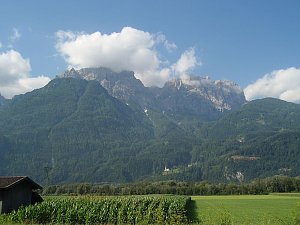
The highest peak of the Gailtal Alps, located in the Austrian federal state of Tyrol. Grosse Sandspitze is part of the Lienz Dolomites subgroup. The Gailtal Alps belong to the Southern Limestone Alps group.
The first ascent of Grosse Sandspitze was made by Franz Mitterhofer, a farmer from Tristach, on July 2, 1886. The first tourist ascent was accomplished by August Kolp and Ignaz Linder a few days later on July 20, 1886.
Access
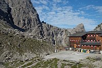
From the Oberdrautal valley, drive from the village of Lavant along the mountain road to the parking lot at the Dolomiten Hütte (1616 m above sea level).
Ascent
There is no normal hiking route to the summit, only two secured routes:
- from the south side, the Ari-Schübel-Steig (difficulty B/C), and
- from the north side, a long and demanding secured route, the Sepp-Oberlechner Gedächtnis Weg (difficulty C/D-D).
From the Dolomitten Hütte, it is possible to ascend via a wide comfortable path to the Karlsbader Hütte. Another option is the simple secured route Rudi-Eller-Weg, which runs below the western wall of the Laserzwand peak and connects to the normal ascent route just below the Karlsbader Hütte. Just before the Karlsbader Hütte, turn left up according to the signpost. The path ascends through a scree slope and after about 20 minutes, it splits: the left path leads to the green-marked Gebirgsjägersteig and the straight path continues along the blue-marked Ari-Schübel-Steig. A pleasant combination is to use the Gebirgsjägersteig as the ascent route and the Ari-Schübel-Steig as the descent route. So, turn left and after a while, we reach the base of the secured route Gebirgsjägersteig. This is a moderately difficult secured route (B/C). Part of the route runs along the southern wall and part of it through a constantly snow-covered gully. At the end of the Gebirgsjägersteig, we connect to the Ari-Schübel-Steig, bypass the Kleine Sandspitze summit to the north side into a small rock crevice, and here follows the most difficult section of the secured route and the ascent to the very summit.
on the way down/up is the Karlsbader Hütte
Peak is not stroller accessible.
There are views from the peak.
There is no cable car to this peak.
the summit is accessible via ferrata - Panorama klettersteig
Peak is freely accessible.
Nearest peaks: Daumen (2720 m, 0.1 km) Kleine Sandspitze (2761 m, 0.1 km) Grosser Galizenspitze (2710 m, 0.3 km) Grosser Laserzkopf (2718 m, 0.5 km) Schöttnerspitze (2617 m, 0.8 km) Kleine Laserzwand (2568 m, 0.9 km) Laserzwand (2614 m, 1 km) Seekofel (2738 m, 1.2 km) Teplitzer Spitze (2609 m, 1.6 km) Auerlingköpfl (2026 m, 1.8 km) Simonskopf (2685 m, 1.9 km) Kleine Gamswiesenspitze (2454 m, 2.1 km) Grosse Gamswiesenspitze (2486 m, 2.2 km) Kirchbichl (810 m, 3.6 km)
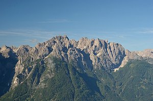 Výstup na Grosse Laserzwand v Lienzských Dolomitech
| today | tomorrow | day after tomorrow | |
|---|---|---|---|
| Dawn: | 6:11 | 6:12 | 6:13 |
| Sunrise: | 6:42 | 6:43 | 6:45 |
| Sunset: | 17:03 | 17:01 | 17:00 |
| Dusk: | 17:34 | 17:32 | 17:31 |

