Sattelnock (2033 m a.s.l., Gailtal Alps)
Register and log summit
Weather Sattelnock

About peak Sattelnock
 Rakousko
Vrchol Sattelnock was added here by Jan Blažej.
Help others and .
- Chalet/accommodation
-
There is no chalet on the peak.
- Stroller access
-
Peak is not stroller accessible.
- Views
-
There are views from the peak.
- Cable car
-
There is no cable car to this peak.
- Equipment
-
No special equipment is required for this summit.
- Accessibility
-
Peak is freely accessible.

Webcams
Gitschtal: Schigebiet Weißbriach
( 3.4 km)
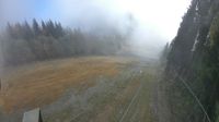 Weissbriach: Schigebiet - Berggeisthütte
( 3.4 km)
 Weissbriach: Bergbahnen
( 4.6 km)
 Gitschtal: Bergbahnen Weißbriach
( 4.6 km)
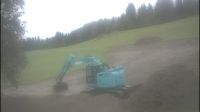 Greifenburg › North: Modellflugplatz Glocknerhof - Emberger Alm
( 5.9 km)
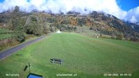 Greifenburg: Panoramakamera der Tourismusgemeinde
(587 m a.s.l., 6 km)
 Greifenburg: Badesee
( 6 km)
 Weissensee: Panoramakamera Erlebnishof Tschabitscher
(1062 m a.s.l., 6.3 km)
 Berg im Drautal › South-east: Modellflugplatz Glocknerhof
( 6.5 km)
 Berg im Drautal: Hotel Glocknerhof
(639 m a.s.l., 6.9 km)
 Berg im Drautal: Hotel Glocknerhof
(653 m a.s.l., 6.9 km)
 Berg im Drautal: Hotel Glocknerhof
(653 m a.s.l., 6.9 km)
 Berg im Drautal › South: Hotel Glocknerhof - Modellflugplatz Glocknerhof - Amlach - Greifenburg - Greifenburg-Weißensee - Reißkofel - Drautal
( 7 km)
 Berg im Drautal: Berg at Dravavalley
( 7.2 km)

Cameras provided by windy.com
( 3.4 km)
Weissbriach: Schigebiet - Berggeisthütte( 3.4 km)
Weissbriach: Bergbahnen( 4.6 km)
Gitschtal: Bergbahnen Weißbriach( 4.6 km)
Greifenburg › North: Modellflugplatz Glocknerhof - Emberger Alm( 5.9 km)
Greifenburg: Panoramakamera der Tourismusgemeinde(587 m a.s.l., 6 km)
Greifenburg: Badesee( 6 km)
Weissensee: Panoramakamera Erlebnishof Tschabitscher(1062 m a.s.l., 6.3 km)
Berg im Drautal › South-east: Modellflugplatz Glocknerhof( 6.5 km)
Berg im Drautal: Hotel Glocknerhof(639 m a.s.l., 6.9 km)
Berg im Drautal: Hotel Glocknerhof(653 m a.s.l., 6.9 km)
Berg im Drautal: Hotel Glocknerhof(653 m a.s.l., 6.9 km)
Berg im Drautal › South: Hotel Glocknerhof - Modellflugplatz Glocknerhof - Amlach - Greifenburg - Greifenburg-Weißensee - Reißkofel - Drautal( 7 km)
Berg im Drautal: Berg at Dravavalley( 7.2 km)
Sun
| today | tomorrow | day after tomorrow | |
|---|---|---|---|
| Dawn: | 7:05 | 7:06 | 6:08 |
| Sunrise: | 7:36 | 7:37 | 6:39 |
| Sunset: | 18:06 | 18:05 | 17:03 |
| Dusk: | 18:37 | 18:36 | 17:34 |