
Hiking, 14 km
16.8.2025 to 17.8.2025
 Itálie
Logged on Vrcholovka 12x in total. Vrchol Punta Giordani / Giordanispétz was added here by Milan "Hojší" Průžek and info was completed by Milan "Hojší" Průžek, Pája, Martin Matějka a Bouřka.
Punta Giordani / Giordanispétz is part of challenges: 39 quattromila italiani, Alpine Four-thousanders
Punta Giordani (4046 m a.s.l.) is a mountain in the Wallis Alps. It is located in Italy on the border of the Valle d'Aosta and Piedmont regions, near the Swiss border. It belongs to the Monte Rosa massif. It is adjacent to Ludwigshöhe and Piramide Vincent. The summit can be reached from the Capanna Giovanni Gnifetti hut (3647 m a.s.l.). Below the mountain lies the Indren glacier. The mountain was first ascended on July 23, 1801, by Pietro Giordani.
It is surprising that the summit is included in the official UIAA list of 4000ers, given that its prominence is only 18 m, but that is the case.
After a personal visit, I am changing the prominence according to reality - the 18 m prominence (which unfortunately is also stated by peakvisor.com) is merely a dream; the real prominence is 5-6 m, and who knows if that is even accurate. The ascent via the steep glacier is not entirely straightforward; it is very steep (be cautious of falling rocks during the descent in the afternoon!), and reaching the summit rock requires dealing with significant exposure and several climbing moves of difficulty I+ /Storm/
There is no chalet on the peak.
Peak is not stroller accessible.
There are views from the peak.
There is no cable car to this peak.
Glacier equipment required.
Peak is freely accessible.
Nearest peaks: Pyramid Vincent (4215 m, 0.6 km) Schwarzhorn / Corno Nero (4321 m, 1.1 km) Balmenhorn (4167 m, 1.2 km) Ludwigshöhe (4341 m, 1.3 km) Punta Giovanni Gnifetti (3646 m, 1.5 km) Parrotspitze / Punta Parrot (4443 m, 1.6 km) Colle del Lys (4254 m, 1.7 km) Punta Indren SV (3306 m, 1.7 km) Punta Indren (3275 m, 1.8 km) Rifugio Mantova (3510 m, 1.9 km) Entdeckungsfelsen (4178 m, 2.1 km) Colletto dell'Acqua (3201 m, 2.2 km) Signalkuppe / Punta Gnifetti (4554 m, 2.5 km) Cima di Scoperta (4335 m, 2.6 km) Stolemberg (3202 m, 2.6 km) Punta Luce (3348 m, 2.8 km) Zumsteinspitze / Punta Zumstein (4563 m, 3 km) Punta Salza (2909 m, 3.8 km)
 Výstup na čtyřtisícovku Castor od jihu z italského Grenne
 Největším alpským masivem Monte Rosa na Punta Dufour neboli Dufourspitze
Výstup masivem Monte Rosy na Dufourspitze v Alpách
Výstup na Castor (4226 m) ze švýcarského Zermattu přes Rif. Lambronecca
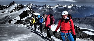 Výstup na čtvrtý nejvyšší vrchol Alp – Lyskamm
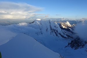 Výstup na Cresta Signal neboli Signalkuppe východním hřebenem z Itálie
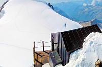
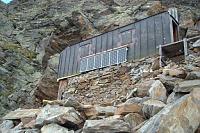
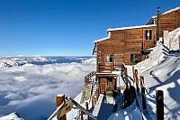
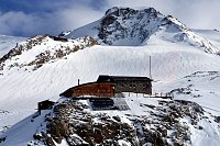
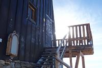
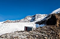
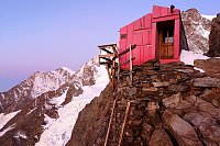
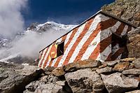
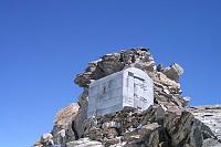
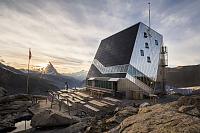
 Gressoney-La-Trinite: Monte Rosa
 Gressoney-La-Trinite
 Gressoney-La-Trinite
 Macugnaga
 Macugnaga
 Alagna Valsesia › North
 Alagna Valsesia › South-East
 Weng: Passo dei Salati − Alagna Valsesia
 Alagna Valsesia: Pianalunga, Alagna - Valsesia
 Gressoney-La-Trinite: Gressoney-La-Trinité, Monterosa - Gabiet, Telecabina Gabiet-Passo dei Salati
 Gressoney-La-Trinite: Gressoney-La-Trinité, Monterosa - Gabiet
 Gressoney-La-Trinite: Gressoney-La-Trinité, Monterosa - Gabiet
 Gressoney-La-Trinite: Gressoney-La-Trinité, Monterosa - Gabiet, Monte Rosa
 Gressoney-La-Trinite: Gressoney-La-Trinité, Monterosa - Gabiet
 Gressoney-La-Trinite: Gressoney-La-Trinité, Monterosa - Gabiet
 Macugnaga: monte rosa rifugio zamboni zappa
 Zermatt: Monte Rosa
 Macugnaga › East

| today | tomorrow | day after tomorrow | |
|---|---|---|---|
| Dawn: | 6:39 | 6:40 | 6:41 |
| Sunrise: | 7:10 | 7:11 | 7:13 |
| Sunset: | 17:13 | 17:12 | 17:11 |
| Dusk: | 17:45 | 17:43 | 17:42 |