

Hiking, 22 km
1.3.2026
 Česko
Šumperk (Olomoucký kraj)
Logged on Vrcholovka 200x in total. Spočinek Kamzičník was added here by Petr Pepe Peloušek and info was completed by krupjan, Martin Matějka a ZdenkaV.
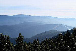
The place called Kamzičník is part of the Hrubý Jeseník mountain range and is located on the border of two regions, Moravian-Silesian and Olomouc, southwest of Ovčárna in an area known as Velký kotel, on the southwestern slope of Vysoká hole. It is marked by a pole and a red hiking trail runs around it, indicating the ridge route from the Ovčárna mountain hut to Jelení studánka. There is a beautiful view of the surrounding peaks of the Jeseníky, and to the north, we can see the highest peak of the Jeseníky, Praděd.
There is no chalet on the peak.
Peak is not stroller accessible.
There are views from the peak.
There is no cable car to this peak.
No special equipment is required for this summit.
Peak is freely accessible.
Nearest peaks: Vysoká hole (1465 m, 0.7 km) Velký Máj (1386 m, 1.3 km) Zámčisko S (1264 m, 1.3 km) Malý Máj SZ (1188 m, 1.6 km) Petrovy kameny (1447 m, 1.8 km) Nad soutokem (1062 m, 1.9 km) Above Bear Hollow S (1030 m, 2 km) Nad Medvědím dolem (1040 m, 2 km) Pod Bobinou (1132 m, 2.2 km) Jelení hřbet (1367 m, 2.5 km) Malý Máj (1082 m, 2.7 km) Praděd (1491 m, 3.3 km) Jelenka (1214 m, 3.4 km)
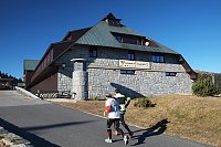
 Mala Moravka: Praděd - Horský hotel Volareza
 Mala Moravka: Praděd - Horský hotel Volareza - Bílá Opava
 Mala Moravka: Praděd - Horský hotel Volareza - Petrovy kameny
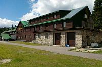
 Rejhotice: Sporthotel Kurzovní - Vysoké hole
 Rejhotice: Sporthotel Kurzovní - Přístup na běžeckou trať
 Rejhotice: Sporthotel Kurzovní - Parkoviště a hlavní vchod
 Rejhotice: Sporthotel Kurzovní - Petrovy kameny
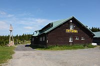
 Karlova Studánka: Sporthotel Kurznovní
 Mala Moravka
 Karlov
 Karlov pod Pradedem: Ski Karlov - areál Karlov - Sjezdovky V Javořinách a Rodinná
 Karlov pod Pradedem: Ski Karlov - areál Karlov - Vyhlídková

| today | tomorrow | day after tomorrow | |
|---|---|---|---|
| Dawn: | 6:00 | 6:02 | 6:03 |
| Sunrise: | 6:34 | 6:35 | 6:37 |
| Sunset: | 16:35 | 16:33 | 16:31 |
| Dusk: | 17:08 | 17:07 | 17:05 |