Suchá hora (1083 m a.s.l., Šumava)
Register and log summit


About peak Suchá hora
 Česko
Český Krumlov (Jihočeský kraj)
Logged on Vrcholovka 15x in total. Peak information here was completed by Pavel Martínek, Martin Matějka, Vladimír Grančay a Bouřka.
Suchá hora is part of challenges: Šumavské tisícovky, The Highest Peaks of South Bohemia, Thousanders of the Czech Republic
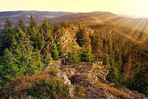
Rocky ridge 4 km east of Záhvozdí. It forms a wide southern edge of the southwestern ridge of Knížecí stůl, separated from it by a wide shallow saddle (1063 m a.s.l.). The summit rock continues on the western slope, reaching a total length of 400 m. There are debris flows around it. The southern slope is steep, with scattered debris. It is forested with spruce. Southeast of Suchá hora is a meadow with a pond and the ruins of the farm U Kokšů. In the summit area (not on the highest rock!) is a geodetic point. (tisicovky.cz)
1/2025: I am updating the height and prominence according to measurements on ags.cuzk.cz. The stated height of 1080 m is the height of the triangulation point (1080.2 m), the actual height is higher due to the rocks - analyses after measurement “returned” a value of 1083.3 m, numerically indicating a height of 1086.5 m on the map, but this was not confirmed by the survey. /Storm/
- Chalet/accommodation
-
There is no chalet on the peak.
- Stroller access
-
Peak is not stroller accessible.
- Views
-
Partial view to the S to E.
- Cable car
-
There is no cable car to this peak.
- Equipment
-
No special equipment is required for this summit.
- Accessibility
-
VVP Boletice, about 100 meters from the previously marked path (mark removed 2024).
Nearest peaks: Suchá hora ZSZ (1081 m, 0.2 km) Adolfův kámen (1073 m, 0.3 km) Nad Adolfovskou cestou (1029 m, 0.6 km) Nad Adolfovskou cestou SZ (1005 m, 1 km) Umrlčí hlava (1150 m, 1.1 km) Under Žumberská Path (1033 m, 1.1 km) Suchá hora SZ (1016 m, 1.2 km) Hvězda SZ (1145 m, 1.5 km) Hvězda (1155 m, 1.6 km) Hvězdáře (1160 m, 1.6 km) Nad Žumberskou cestou (1110 m, 1.6 km) Bulov SZ1 (963 m, 1.7 km) Hvězda JV (1144 m, 1.7 km) Hvězda Z (989 m, 1.7 km) Hvězda Z2 (977 m, 1.7 km) Bulov SZ2 (956 m, 1.8 km) Bulov SZ3 (953 m, 1.8 km) Knížecí stolec (1236 m, 1.8 km) Skalky (1130 m, 1.8 km) Uhlíkovský kopec (1011 m, 1.8 km) Bulov SZ4 (944 m, 1.9 km) Černý les (1007 m, 1.9 km) Nad Hospodárnicí Z (1182 m, 2 km) Nad Hospodárnicí Z2 (1181 m, 2.1 km) Nad Hospodárnicí (1187 m, 2.2 km) Nad Mýtinou (945 m, 2.2 km) Nad Novým Špičákem (1084 m, 2.2 km) Černý les SSZ (946 m, 2.3 km) Lysá Z (1192 m, 2.3 km) Uhlíkovský kopec S (986 m, 2.3 km) Lysá SZ (1140 m, 2.4 km) Nad Hájovnou (995 m, 2.5 km) Knížecí stolec SZ (1086 m, 2.6 km) Dlouhý hřbet V (1083 m, 2.7 km) Lysá (1228 m, 2.7 km) Nad Slatinkou (1188 m, 2.9 km) Kapradinec S (1099 m, 3 km) Horní les (952 m, 3.1 km) Nad Novou Tyrolkou (1057 m, 3.1 km) Kapradinec (1088 m, 3.2 km) Lysá SZ2 (964 m, 3.3 km) Dlouhý hřbet (1090 m, 3.6 km) Dlouhý hřbet Z (1053 m, 3.9 km)
Routes nearby
(elevation gain 10400 m, 1051 km)
 Přechod NP Šumava
(elevation gain 2456 m, 101 km)
Webcams
(748 m a.s.l., 7.4 km)
 Horní Planá › South-East: Jihočeský
(765 m a.s.l., 7.6 km)

Sun
| today | tomorrow | day after tomorrow | |
|---|---|---|---|
| Dawn: | 7:04 | 7:05 | 6:07 |
| Sunrise: | 7:36 | 7:38 | 6:39 |
| Sunset: | 17:59 | 17:58 | 16:56 |
| Dusk: | 18:32 | 18:30 | 17:28 |