British Hercynides
British Hercynides include the British mountain ranges formed during the Hercynian orogeny: southwestern Ireland (including the highest peak Carrauntoohil, 1041 m), northern England (including the Lake District with the highest English mountain Scafell Pike, 978 m) and southwestern England. The lowland remainder of England belongs to the Epihercynian lowlands (specifically the North Sea basin), and the rest of the British Isles (Scotland, Wales, most of Ireland, the Isle of Man...) belongs to the Caledonian system.
| Highest peak | Carrauntoohil (1041 m a.s.l.) |
|---|---|
| Most prominent peak | Carrauntoohil (1041 m a.s.l., prominence 1041 m) |
| Parent unit | Hercynian Mountains |
| Sub-units |
Slieve Mish MacGillycuddy's Reeks Caha Mountains Shehy Mountains Cumbrian Mountains Pennines Dartmoor |
| Main peaks | Total 37 |
| Most popular peaks | Carrauntoohil (1041 m a.s.l.), Mount Brandon (952 m a.s.l.), Dunmore Head (90 m a.s.l.), Scafell Pike (978 m a.s.l.), Cnoc na Toinne (845 m a.s.l.) |
| Mountain range challenges | Highest Geographical Points of Europe, Highest Mountains of European Countries |

| Name | Elevation | ||||
|---|---|---|---|---|---|

|
Carrauntoohil | 1041 m a.s.l. | MacGillycuddy's Reeks | 1041 m | hlavní vrchol |

|
Beenkeragh | 1008 m a.s.l. | MacGillycuddy's Reeks | 103 m | hlavní vrchol |

|
Caher | 1000 m a.s.l. | MacGillycuddy's Reeks | 109 m | hlavní vrchol |

|
Scafell Pike | 978 m a.s.l. | Cumbrian Mountains | 912 m | hlavní vrchol |

|
Caher West Top | 973 m a.s.l. | MacGillycuddy's Reeks | 24 m | hlavní vrchol |

|
Sca Fell | 964 m a.s.l. | Cumbrian Mountains | 140 m | hlavní vrchol |

|
Mount Brandon | 952 m a.s.l. | Slieve Mish | 930 m | hlavní vrchol |

|
Helvellyn | 950 m a.s.l. | Cumbrian Mountains | 710 m | hlavní vrchol |

|
Skiddaw | 931 m a.s.l. | Cumbrian Mountains | 734 m | hlavní vrchol |

|
Mullach Thuaidh | 895 m a.s.l. | Slieve Mish | 44 m | hlavní vrchol |

|
Cross Fell | 893 m a.s.l. | Pennines | 646 m | hlavní vrchol |

|
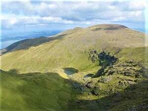
Grasmoor | 852 m a.s.l. | Cumbrian Mountains | 519 m | hlavní vrchol |
|
Baurtregaum | 851 m a.s.l. | Slieve Mish | 644 m | hlavní vrchol |

|
Cnoc na Toinne | 845 m a.s.l. | MacGillycuddy's Reeks | 78 m | hlavní vrchol |

|
Beenoskee | 826 m a.s.l. | Slieve Mish | 490 m | hlavní vrchol |
|
|
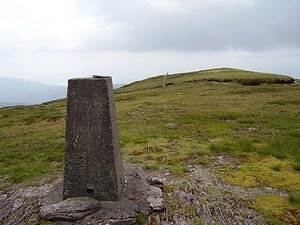
Stradbally Mountain | 798 m a.s.l. | Slieve Mish | 51 m | hlavní vrchol |
|
Knockboy | 706 m a.s.l. | Shehy Mountains | 609 m | hlavní vrchol |

|
Knocknadobar | 690 m a.s.l. | MacGillycuddy's Reeks | 565 m | hlavní vrchol |
|
|
Hungry Hill | 682 m a.s.l. | Caha Mountains | 390 m | hlavní vrchol |

|
High Willhays | 621 m a.s.l. | Dartmoor | 537 m | hlavní vrchol |

|
Coombane | 610 m a.s.l. | Slieve Mish | 39 m | hlavní vrchol |

|
Lackabane | 603 m a.s.l. | Caha Mountains | 293 m | hlavní vrchol |

|
Eskatarriff | 601 m a.s.l. | Caha Mountains | 143 m | hlavní vrchol |

|
Coomacloghane | 599 m a.s.l. | Caha Mountains | 104 m | hlavní vrchol |

|
Tooth Mountain | 592 m a.s.l. | Caha Mountains | 47 m | hlavní vrchol |

|
Derryclancy | 554 m a.s.l. | Caha Mountains | 105 m | hlavní vrchol |
|
|
Eskatarrif East Top | 533 m a.s.l. | Caha Mountains | 39 m | hlavní vrchol |
|
|
Coombane | 510 m a.s.l. | Caha Mountains | 15 m | hlavní vrchol |
|
|
Knocknaveacal | 509 m a.s.l. | Caha Mountains | 34 m | hlavní vrchol |
|
|
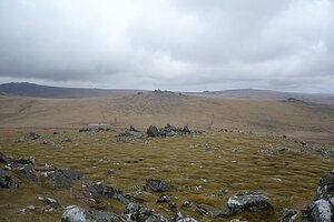
Knocknagree East Top | 461 m a.s.l. | Caha Mountains | 39 m | hlavní vrchol |
|
Cox Tor | 443 m a.s.l. | Dartmoor | 50 m | hlavní vrchol |
|
|
Tooreenbaha | 409 m a.s.l. | Caha Mountains | 43 m | hlavní vrchol |

|
Mount Gabriel | 407 m a.s.l. | British Hercynides | 362 m | hlavní vrchol |
|
|
Geokaun | 266 m a.s.l. | MacGillycuddy's Reeks | 266 m | hlavní vrchol |
|
|
Cnoicín an tSeabhaic | 160 m a.s.l. | British Hercynides | 160 m | hlavní vrchol |
|
|
Dunmore Head | 90 m a.s.l. | Slieve Mish | 55 m | hlavní vrchol |
|
|
Faill Diarmada | 75 m a.s.l. | British Hercynides | 52 m | hlavní vrchol |