

Hiking
ne, 6.3.2005, 13:40

 Irsko
Logged on Vrcholovka 1x in total. Vrchol Eskatarriff was added here by Bouřka and info was completed by Martin Matějka.
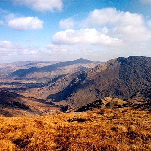
Irish Eisc an Tairbh. The second highest peak of the very distinctive and beautiful Cumeengeera Horseshoe; gentle slopes to the southwest, steeply dropping to the end of the valley (the Pocket) to the southeast. The terrain is grassy, with some areas of peat. Beautiful views of both parts of the horseshoe and the steep west face of the peak Lackabane. Completely without paths or markings.
Note: mapy.cz is based on OpenStreetMap with an incorrect height of 653m, which does not correspond to the surrounding contour lines. The height of 601m is reported by both the Irish paper map and the website mountainviews.ie - an online database for collectors of peaks in the British Isles.
There is no chalet on the peak.
Peak is not stroller accessible.
There are views from the peak.
There is no cable car to this peak.
No special equipment is required for this summit.
Peak is freely accessible.
Nearest peaks: Eskatarrif East Top (533 m, 0.7 km) Coomacloghane (599 m, 1.5 km) Lackabane (603 m, 1.5 km) Tooth Mountain (592 m, 2.1 km) Knocknagree East Top (461 m, 2.5 km) Knocknaveacal (509 m, 3 km)
| today | tomorrow | day after tomorrow | |
|---|---|---|---|
| Dawn: | 7:43 | 7:45 | 6:46 |
| Sunrise: | 8:17 | 8:19 | 7:21 |
| Sunset: | 18:29 | 18:27 | 17:25 |
| Dusk: | 19:03 | 19:01 | 18:00 |