



Hiking
pá, 19.11.2004, 15:32
 Irsko
Logged on Vrcholovka 1x in total. Vrchol Mount Gabriel was added here by Bouřka and info was completed by Martin Matějka.
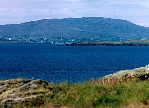
The highest point of the Sheeps and Mizen peninsulas south of Bantry Bay. Very easily accessible and offering a fantastic view on a clear day, not only towards the north to the mountain peninsulas of Ireland, but also into its interior and the endless expanse of the Atlantic Ocean.
Note: mapy.cz is based on OpenStreetMap with an incorrect height of 459m, which does not correspond to the surrounding contour lines. A height of 407m is reported by both the Irish paper map and the website mountainviews.ie - an online database for summit collectors of the British Isles.
Photo: Storm; 8/2004 from Cape Clear
There is no chalet on the peak.
This peak is accessible with a stroller.
There are views from the peak.
There is no cable car to this peak.
No special equipment is required for this summit.
Peak is freely accessible.
| today | tomorrow | day after tomorrow | |
|---|---|---|---|
| Dawn: | 7:43 | 6:45 | 6:46 |
| Sunrise: | 8:17 | 7:19 | 7:21 |
| Sunset: | 18:26 | 17:24 | 17:22 |
| Dusk: | 19:01 | 17:59 | 17:57 |