Villgratenské hory
| Highest peak | Weisse Spitze (2962 m a.s.l.) |
|---|---|
| Most prominent peak | Weisse Spitze (2962 m a.s.l., prominence 919 m) |
| Parent unit | Vysoké Taury |
| Main peaks | Total 42 |
| Most popular peaks | Thurntaler (2408 m a.s.l.), Rote Wand (2818 m a.s.l.), Hörneckele (2127 m a.s.l.), Hochstein (2464 m a.s.l.), P2277 (2277 m a.s.l.) |
| Mountain range challenges | Austrian Alps |

| Name | Elevation | ||||
|---|---|---|---|---|---|

|
Weisse Spitze | 2962 m a.s.l. | Villgratenské hory | 919 m | hlavní vrchol |
|
Rote Spitze | 2955 m a.s.l. | Villgratenské hory | 233 m | hlavní vrchol |
|
Hochgrabe | 2951 m a.s.l. | Villgratenské hory | 295 m | hlavní vrchol |

|
Great Sword Horn | 2946 m a.s.l. | Villgratenské hory | 257 m | hlavní vrchol |
|
|
Gölbner | 2943 m a.s.l. | Villgratenské hory | 383 m | hlavní vrchol |

|
Gumriaul | 2917 m a.s.l. | Villgratenské hory | 120 m | hlavní vrchol |
|
Regenstein | 2891 m a.s.l. | Villgratenské hory | 319 m | hlavní vrchol |
|
Small Sword Horn | 2849 m a.s.l. | Villgratenské hory | 15 m | hlavní vrchol |

|
Deferegger Pfannhorn | 2820 m a.s.l. | Villgratenské hory | 53 m | hlavní vrchol |

|
Rote Wand | 2818 m a.s.l. | Villgratenské hory | 877 m | hlavní vrchol |

|
Grosser Leppleskofel | 2811 m a.s.l. | Villgratenské hory | 38 m | hlavní vrchol |
|
|
Hochalmspitze | 2797 m a.s.l. | Villgratenské hory | 216 m | hlavní vrchol |

|
Kugelspitze | 2796 m a.s.l. | Villgratenské hory | 91 m | hlavní vrchol |
|
|
Red Kinkele | 2763 m a.s.l. | Villgratenské hory | 42 m | hlavní vrchol |
|
|
Rotlahner | 2743 m a.s.l. | Villgratenské hory | 103 m | hlavní vrchol |
|
|
Hochwand | 2728 m a.s.l. | Villgratenské hory | 116 m | hlavní vrchol |
|
|
Rotstein | 2702 m a.s.l. | Villgratenské hory | 186 m | hlavní vrchol |

|
Kahorn | 2692 m a.s.l. | Villgratenské hory | 134 m | hlavní vrchol |
|
|
Amperspitze | 2688 m a.s.l. | Villgratenské hory | 294 m | hlavní vrchol |
|
|
Langschneid | 2688 m a.s.l. | Villgratenské hory | 197 m | hlavní vrchol |
|
|
Grabenstein | 2665 m a.s.l. | Villgratenské hory | 70 m | hlavní vrchol |

|
Gabesitten | 2665 m a.s.l. | Villgratenské hory | 60 m | hlavní vrchol |
|
|
Lavantegg | 2658 m a.s.l. | Villgratenské hory | 83 m | hlavní vrchol |
|
|
Schlaitner Kofel | 2650 m a.s.l. | Villgratenské hory | 15 m | hlavní vrchol |
|
|
Finsterkofel | 2643 m a.s.l. | Villgratenské hory | 67 m | hlavní vrchol |
|
|
Schönbergspitze | 2640 m a.s.l. | Villgratenské hory | 113 m | hlavní vrchol |
|
|
Sauspitze | 2604 m a.s.l. | Villgratenské hory | 29 m | hlavní vrchol |
|
|
Hoher Mann | 2593 m a.s.l. | Villgratenské hory | 100 m | hlavní vrchol |
|
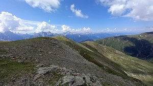
Reisachspitze | 2587 m a.s.l. | Villgratenské hory | 107 m | hlavní vrchol |
|
Monte della Chiesa | 2553 m a.s.l. | Villgratenské hory | 177 m | hlavní vrchol |
|
|
Tullenkogel | 2552 m a.s.l. | Villgratenské hory | 17 m | hlavní vrchol |
|
|
Hintere Lavantspitze | 2546 m a.s.l. | Villgratenské hory | 101 m | hlavní vrchol |
|
Cornetto Di Confine | 2545 m a.s.l. | Villgratenské hory | 45 m | hlavní vrchol |
|
|
Böses Weibele | 2521 m a.s.l. | Villgratenské hory | 68 m | hlavní vrchol |

|
Fellhorn | 2518 m a.s.l. | Villgratenské hory | 126 m | hlavní vrchol |
|
|
Vordere Lavantspitze | 2516 m a.s.l. | Villgratenské hory | 41 m | hlavní vrchol |
|
Sasso Planca | 2483 m a.s.l. | Villgratenské hory | 43 m | hlavní vrchol |

|
Kleiner Leppleskofel | 2469 m a.s.l. | Villgratenské hory | 33 m | hlavní vrchol |

|
Hochstein | 2464 m a.s.l. | Villgratenské hory | 34 m | hlavní vrchol |

|
Ausserriedl | 2428 m a.s.l. | Villgratenské hory | 10 m | vedlejší vrchol |
|
|
Ternegg | 2422 m a.s.l. | Villgratenské hory | 2 m | spočinek/ostatní |

|
Thurntaler | 2408 m a.s.l. | Villgratenské hory | 73 m | hlavní vrchol |
|
|
Rieder Gampen | 2390 m a.s.l. | Villgratenské hory | 7 m | vedlejší vrchol |
|
|
Dreiheggenspitze | 2368 m a.s.l. | Villgratenské hory | 13 m | vedlejší vrchol |
|
|
Hirschbichl | 2141 m a.s.l. | Villgratenské hory | 18 m | hlavní vrchol |

|
Hörneckele | 2127 m a.s.l. | Villgratenské hory | 10 m | vedlejší vrchol |
|
|
Bockstein | 2083 m a.s.l. | Villgratenské hory | 197 m | hlavní vrchol |