Aiguille du Jardin (4035 m a.s.l., Mont Blanc)
Register and log summit


About peak Aiguille du Jardin
 Francie
Vrchol Aiguille du Jardin was added here by Milan "Hojší" Průžek and info was completed by Milan "Hojší" Průžek.
Aiguille du Jardin is part of challenges: 24 quatre-mille français, Alpine Four-thousanders
Aiguille du Jardin is a smaller peak in the Aiguille Verte massif. It features the following summits exceeding 4000 m:
- Aiguille Verte (4,122 m)
- Grande Rocheuse (4,102 m)
- Aiguille du Jardin (4,035 m)
- Les Droites (4,000 m)
- Aiguille du Jardin, a mountain that must defend its place between Aiguille Verte and the summit of Droites, which stretches more than a kilometer long
- on the side of the Argentière glacier, it consists of pillars and couloirs, while on the side of the Talèfre glacier, it appears bulky and is essentially made of rock
- the mountain is bordered on the right by a couloir leading to the Armanda Charleta pass and the rocky ridge Arête du Jardin
The summit can be reached from the Refuge du Couvercle (2,687 m) on the French side and from Rifugio del Trient (3,170 m) on the Swiss side.
The mountain was first ascended on August 1, 1904, by Jean Ravanel, Léon Tournier, and E. Fontaine.
- Chalet/accommodation
-
There is no chalet on the peak.
- Stroller access
-
Peak is not stroller accessible.
- Views
- Cable car
-
There is no cable car to this peak.
- Equipment
-
Special equipment is required for this summit.
- Accessibility
Nearest peaks: Grande Rocheuse (4102 m, 0.3 km) Aiguille Verte (4122 m, 0.5 km) Les Droites (4000 m, 1.1 km) Grand Dru (3754 m, 1.5 km) Petit Dru (3733 m, 1.7 km)
Routes nearby
(elevation gain 300 m, 6 km)
 Přechod Grandes Jorasses: VHT túra snů
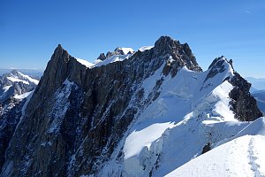 Výstup na Aiguille du Chardonnet vstupenka do alpinismu
(elevation gain 2600 m, 20 km)
Alpský výstup na Pyramide du Tacul východní hranou(elevation gain 700 m, 10 km)
Výstup na Arete des Cosmiques na Aiguille du Midi(elevation gain 400 m, )
Webcams
( 2.6 km)
 Chamonix-Mont-Blanc › North-East: Aiguille du Tacul - Grandes Jorasses
(-32768 m a.s.l., 2.7 km)
 Chamonix-Mont-Blanc: Aiguille du Tacul - Grandes Jorasses
(-32768 m a.s.l., 2.7 km)
 Chamonix-Mont-Blanc › North-East: Argentière Hut
(-32768 m a.s.l., 2.7 km)
 Chamonix-Mont-Blanc › South-East: Aiguille du Tacul - Grandes Jorasses
(-32768 m a.s.l., 2.7 km)
 Chamonix-Mont-Blanc
( 2.8 km)
 Argentière: Grands Montet at Lognan looking to Herse
(2058 m a.s.l., 4.2 km)
 Chamonix-Mont-Blanc: Les Grands Montets
( 4.2 km)
 Chamonix-Mont-Blanc
( 4.5 km)
 Chamonix-Mont-Blanc › South-west: Les Grands Montets - bochard G2
( 4.5 km)
 Chamonix-Mont-Blanc › South-East: Mer de Glace
( 4.5 km)
 Chamonix-Mont-Blanc: Gare du Montenvers Mer de Glace
( 4.5 km)
 Alpes Chamonix Mont Blanc
(1917 m a.s.l., 4.5 km)
 Chamonix: Gare du Montenvers Mer de Glace
(1929 m a.s.l., 4.5 km)
 Chamonix: Téléphérique des Grands Montets
(1959 m a.s.l., 4.6 km)
 Chamonix-Mont-Blanc › South-west: Les Grands Montets
( 4.6 km)
 Mer de Glace − Mont Blanc
(1907 m a.s.l., 4.6 km)
 Chamonix-Mont-Blanc › South: Chemin de la Glacière
( 6.2 km)
 Chamonix-Mont-Blanc › West: Parking des Grands Montets
( 6.3 km)
 Chamonix-Mont-Blanc
( 6.4 km)
 Chamonix-Mont-Blanc › East: Argentière - Eglise St Pierre d'Argentière
( 6.7 km)
 Chamonix-Mont-Blanc › South-East
( 6.8 km)

Sun
| today | tomorrow | day after tomorrow | |
|---|---|---|---|
| Dawn: | 6:41 | 6:42 | 6:44 |
| Sunrise: | 7:12 | 7:13 | 7:15 |
| Sunset: | 17:18 | 17:17 | 17:15 |
| Dusk: | 17:49 | 17:48 | 17:47 |