Untere Rötspitze (3289 m a.s.l., Venediger)
Register and log summit

About peak Untere Rötspitze
 Itálie
 Rakousko
Vrchol Untere Rötspitze was added here by Milan "Hojší" Průžek and info was completed by Jiří Králík.
Untere Rötspitze (Italian: Spalla di Rosso) is a 3289 m high peak located in the Umbalkamm mountain ridge in the Venediger group directly on the state border between Austria and Italy. The first ascent of Untere Rötspitze was made by Theodor Harpprecht and Josef Schnell on August 1, 1871, via the northeast ridge of Rötspitze.
Location
Untere Rötspitze is situated on the border between East Tyrol and South Tyrol, specifically between the municipalities of Prägraten am Großvenediger and Prettau. Untere Rötspitze is one of the peaks located on the long northeast ridge of Rötspitze, which extends from Rötspitze over Untere Rötspitze and Virgilkopf (3036 m) to Vorderer Umbaltörl (2926 m). To the east of Untere Rötspitze is the Philipp-Reuter-Hütte hut in the Umbaltal valley, and to the west is the Lenkjöchlhütte hut between the Windtal and Röttal valleys. The summit area of Untere Rötspitze is glaciated. To the west are the Nördliches Rötkees and Mittlere Rötkees glaciers, and to the east is the Welitzkees glacier. The southern slopes of the mountain on the South Tyrolean side are protected in the Italian Rieserferner-Ahrn Nature Park, while the slopes on the East Tyrolean side are protected in the Austrian Hohe Tauern National Park.
Climbing Options
When climbing Rötspitze via the northeast ridge, Untere Rötspitze is usually ascended first. This involves an ascent from the Philipp-Reuter-Hütte hut or the lower Clarahütte hut to Vorderes Umbaltörl. Then, Virgilkopf is traversed along the northeast ridge (UIAA II), and from the ridge pass, the firn summit of Untere Rötspitze is reached. Alternatively, one can also ascend to Gratschartl via the moraine slopes from the Philipp-Reuter-Hütte hut. A less demanding route is the ascent from the Lenkjöchlhütte hut along the western slope (UIAA I).
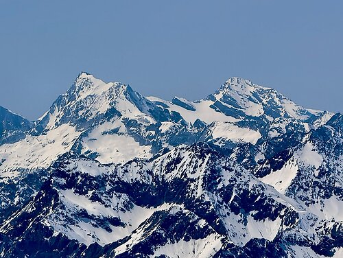
In the photo, it is the smaller peak on the right. On the left is Rotspitze.
- Chalet/accommodation
-
There is no chalet on the peak.
- Stroller access
-
Peak is not stroller accessible.
- Views
-
There are views from the peak.
- Cable car
-
There is no cable car to this peak.
- Equipment
- Accessibility
-
Peak is freely accessible.
Nearest peaks: Rötspitze (3495 m, 0.7 km) Ahrner Kopf / Cima del Vento (3051 m, 1.8 km) Daberspitze (3402 m, 1.8 km) Hoher Rosshuf (3199 m, 3 km)
Routes nearby
(elevation gain 1100 m, 15 km)
 Typický zástupce ledovcové túry - Dreiherrenspitze
(elevation gain 2200 m, 25 km)
Výšlap na Zillerplatenspitze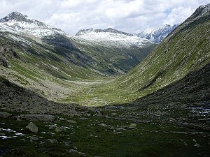 Výstup na Grossvenediger (3666 m) normálkou přes Defreggerhaus
(elevation gain 2500 m, 30 km)
Webcams
Cameras provided by windy.com
Sun
| today | tomorrow | day after tomorrow | |
|---|---|---|---|
| Dawn: | 6:13 | 6:15 | 6:16 |
| Sunrise: | 6:45 | 6:46 | 6:48 |
| Sunset: | 17:05 | 17:03 | 17:01 |
| Dusk: | 17:36 | 17:34 | 17:33 |