Ahrner Kopf / Cima del Vento (3051 m a.s.l., Venediger)
Register and log summit


About peak Ahrner Kopf / Cima del Vento
 Itálie
 Rakousko
Vrchol Ahrner Kopf / Cima del Vento was added here by Milan "Hojší" Průžek.
https://cs.wikipedia.org/wiki/Ahrner_Kopf
Ahrner Kopf (Italian: Cima del Vento) is a peak with an elevation of 3051 m located in the western part of the Venediger mountain group on the Austrian-Italian border between East and South Tyrol. This border coincides here with the boundary between the Rieserferner-Ahrn Nature Park and the Hohe Tauern National Park. Ahrner Kopf is situated on the ridge between Dreiherrnspitze (3499 m) to the northeast and Rötspitze (3496 m) to the south, with the nearest summits being Hoher Rosshuf (3199 m) and Virgilkopf (3036 m). Despite the proximity of much higher and more famous peaks, Ahrner Kopf, framed by the peaks of Vordere and Hintere Umbaltörl (2949 m and 2849 m), is a relatively independent three-thousander that can be quite impressive from certain viewpoints due to its pronounced ridges to the north and south and steep slopes to the west and east.
The mountain is mentioned as early as 1583 in a description of the border stream, then referred to as "Auer Kopf," derived from "Auerhof." This designation was later changed to the current name, which local residents pronounce as Agnakopf. At the initiative of the hut keeper of Lenkjöchlhütte, a summit cross was erected on the mountain in 2004, which was ceremonially opened in the summer of 2005.
Climbing Options
The mountain is usually ascended from the South Tyrolean side. The starting point is Kasern in the inner Ahrntal valley (1595 m). The Lenkjöchlhütte (2603 m) can serve as a base, which can be reached from Kasern either via Röttal or Windtal. About 50 meters below the hut, a marked hiking trail branches off from the path leading from Windtal to the hut. This trail first crosses the northwestern slope of Untere Rötspitze almost level and continues a bit up and down through a gully where long remnants of old snow remain, leading to the western slope of the mountain. By climbing along the ridge, you reach a junction where the path to Vorderer Umbaltörl branches off to the south. From there, a fairly steep trail leads up the western slope of Ahrner Kopf, which reaches its southern ridge just below the summit, over which the last few meters must be overcome. This ascent is not difficult; an alternative, which is only slightly more challenging, is to continue to Vorderen Umbaltörl at the aforementioned junction and from there reach the summit via the southern ridge, which is quite rugged in the lower part. When ascending from East Tyrol, you will likely use this variant mainly in the last meters to the summit. You can ascend to Vordere Umbaltörl from the east from the Clarahütte (2038 m) via Umbaltal, with the Philipp Reuter bivouac (2672 m) located on the path just below Vordere Umbaltörl serving as a base.
The ascent to Ahrner Kopf is also suitable as a ski tour, with the most commonly used route being largely the same as in summer, typically choosing the variant via Windtal. However, in the steep upper area of the western slope, there may be a significant avalanche risk, especially after fresh snowfall and wind loading.
- Chalet/accommodation
-
There is no chalet on the peak.
- Stroller access
-
Peak is not stroller accessible.
- Views
-
There are views from the peak.
- Cable car
-
There is no cable car to this peak.
- Equipment
- Accessibility
-
Peak is freely accessible.
Nearest peaks: Hoher Rosshuf (3199 m, 1.2 km) Untere Rötspitze (3289 m, 1.8 km) Rötspitze (3495 m, 2.5 km) Dreiherrnspitze (3499 m, 3 km)
Routes nearby
(elevation gain 1100 m, 15 km)
 Typický zástupce ledovcové túry - Dreiherrenspitze
(elevation gain 2200 m, 25 km)
Výšlap na Zillerplatenspitze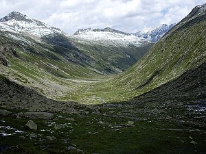 Výstup na Grossvenediger (3666 m) normálkou přes Defreggerhaus
(elevation gain 2500 m, 30 km)
Webcams
Cameras provided by windy.com
Sun
| today | tomorrow | day after tomorrow | |
|---|---|---|---|
| Dawn: | 6:23 | 6:24 | 6:26 |
| Sunrise: | 6:55 | 6:56 | 6:58 |
| Sunset: | 16:53 | 16:52 | 16:51 |
| Dusk: | 17:25 | 17:24 | 17:23 |