Rötspitze (3495 m a.s.l., Venediger)
Register and log summit
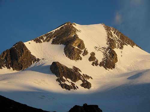

About peak Rötspitze
 Itálie
 Rakousko
Peak information here was completed by Martin Matějka, Bouřka a Milan "Hojší" Průžek.
Rötspitze is part of challenge: TOP 10 Austria
https://cs.wikipedia.org/wiki/R%C3%B6tspitze
Rötspitze (formerly Welitzspitz, Italian Pizzo Rosso, 3496 m a.s.l.) is a mountain in the Hohe Tauern on the Austrian-Italian border. It is located in the Venediger group on the border between Tyrol and South Tyrol. It lies in the Umbalkamm ridge between Untere Rötspitze (3289 m) to the north and Daberspitze (3402 m) to the south. The summit of Daberspitze is separated by the Welitzscharte pass (3181 m). To the west, the Prettaukamm ridge extends from Rötspitze, where it neighbors the summit of Kemetspitze (3004 m). The summit of Kemetspitze is separated by the Rotenmannjoch pass (2887 m). The Rötkees glacier lies on the western and northwestern slopes of the mountain, while Welitzkees is on the eastern side and Schwarzachkees on the southern side.
The first recorded ascent to the summit was made on August 22, 1854, by J. Breymann and colleagues as part of a military survey.
The summit can be reached, for example, via the northern ridge from the Kleine-Philipp-Reuter-Hütte bivouac (2677 m). This is a hike rated at difficulty level III-.
- Chalet/accommodation
-
There is no chalet on the peak.
- Stroller access
-
Peak is not stroller accessible.
- Views
-
There are views from the peak.
- Cable car
-
There is no cable car to this peak.
- Equipment
- Accessibility
-
Peak is freely accessible.
Nearest peaks: Untere Rötspitze (3289 m, 0.7 km) Daberspitze (3402 m, 1.2 km) Ahrner Kopf / Cima del Vento (3051 m, 2.5 km)
Routes nearby
(elevation gain 1100 m, 15 km)
 Typický zástupce ledovcové túry - Dreiherrenspitze
(elevation gain 2200 m, 25 km)
Výšlap na Zillerplatenspitze
Webcams
Cameras provided by windy.com
Sun
| today | tomorrow | day after tomorrow | |
|---|---|---|---|
| Dawn: | 7:09 | 7:11 | 6:12 |
| Sunrise: | 7:40 | 7:42 | 6:43 |
| Sunset: | 18:10 | 18:08 | 17:06 |
| Dusk: | 18:41 | 18:39 | 17:38 |