Hoher Rosshuf (3199 m a.s.l., Venediger)
Register and log summit


About peak Hoher Rosshuf
 Itálie
 Rakousko
Vrchol Hoher Rosshuf was added here by Milan "Hojší" Průžek.
https://cs.wikipedia.org/wiki/Hoher_Rosshuf
Hoher Rosshuf (3199 m a.s.l., Italian Piè di Cavallo) is a peak in the western part of the Venediger mountain group on the Austrian-Italian border between East and South Tyrol. The summit is located in the Rosshuf ridge, which begins at the southwest ridge of Dreiherrnspitze (3499 m a.s.l.) and bears its name. In this ridge, in the immediate vicinity of Hoher Rosshuf, there are other summits including Westlicher Rosshuf (3144 m a.s.l.), Mittlerer Rosshuf (3180 m a.s.l.), and Östlicher Rosshuf (3171 m a.s.l.), with the first two located to the west of Hoher Rosshuf and the third to the northeast. The eastern Tyrolean side of the mountain is part of the Hohe Tauern National Park, while the South Tyrolean parts are protected in the Rieserferner-Ahrn Nature Park.
The first ascent of Hoher Rosshuf was made in 1854 by A. Berger with helpers from the Virgen valley, who believed they were on Dreiherrnspitze. The first ascent of the remote and inaccessible Westlicher Rosshuf was made on July 20, 1904, by E. Franzlin via the western ridge.
Location and surroundings
The Rosshuf ridge stretches from Dreiherrnspitze to Hoher Rosshuf for just over two kilometers to the southwest, with several peaks exceeding the height of Hoher Rosshuf, such as Althausschneideturm at 3275 meters. At Hoher Rosshuf, the Rosshufkamm ridge turns westward, and another side ridge, Umbalkamm, branches southward. In the latter ridge, which leads to Rötspitze (3495 m), another peak, Ahrner Kopf (3050 m), rises, separating Hintere Umbaltörl (2849 m). North of Rosshufkamm lies Lahnerkees with side glaciers, and southeast is Althauskees.
Climbing options
The summit cross at Lenkjöchlhütte before final installation
The easiest ascent is from Hintere Umbaltörl (2849 m) via parts of the southern ridge and southeast slope. Hintere Umbaltörl can be reached from the South Tyrolean side from Lenkjöchlhütte or from the East Tyrolean side from Clarahütte via Vordere Umbaltörl. The route from Hintere Umbaltörl initially heads north, either along the ridge or in the slope to the east of it. Further up, after a flat section of the ridge, it is advantageous to bypass the slabby section of the ridge in the eastern slope at the upper part of Althauskees, which may require glacier equipment. The easiest way is to continue the ascent over the boulder slope southeast of the summit. The route from Umbaltörl includes easy climbing sections (UIAA grade I), but access to Hinteres Umbaltörl has a short climbing section (UIAA II) that is secured. The ascent from Lenkjöchlhütte takes about 2.5 hours, while from Clarahütte, it takes about 4.5 hours.
Summit cross
At the end of September 2014, a new summit cross was erected at the top of Hoher Rosshuf at the request of Richard Steger, the manager of Lenkjöchlhütte, as the previous simple wooden cross needed repair. The new summit cross was shaped like a horseshoe, reflecting the mountain's name. In the middle of the horseshoe, which was about 4.5 meters high and 2 meters wide including the base, a 1.2-meter-high brass cross was to be inserted. However, according to Tyrolean custom, it was to be carried to the summit - unlike the horseshoe, which was transported to the summit by helicopter.
As early as March 2014, Steger submitted a request to the relevant forestry office for permission to erect the summit cross. Six months later, after no decision was made, he initiated the erection at the summit with the assumption that the decision would be positive - as it had been a few years earlier in the case of Ahrner Kopf. Ultimately, in the spring of 2015, after a report in the local newspaper, a negative decision was issued, and Steger was given a short deadline to remove the horseshoe. The reason given was that the summit cross did not conform to the traditional form. In July 2015, the horseshoe was removed by helicopter and now stands at the parking lot at the end of the valley in Kaserntal near the information board of Lenkjöchlhütte.
- Chalet/accommodation
-
There is no chalet on the peak.
- Stroller access
-
Peak is not stroller accessible.
- Views
-
There are views from the peak.
- Cable car
-
There is no cable car to this peak.
- Equipment
- Accessibility
-
Peak is freely accessible.
Nearest peaks: Ahrner Kopf / Cima del Vento (3051 m, 1.2 km) Dreiherrnspitze (3499 m, 2.2 km) Untere Rötspitze (3289 m, 3 km)
Routes nearby
(elevation gain 1100 m, 15 km)
 Typický zástupce ledovcové túry - Dreiherrenspitze
(elevation gain 2200 m, 25 km)
Výšlap na Zillerplatenspitze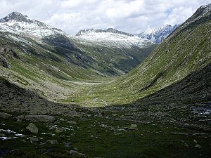 Výstup na Grossvenediger (3666 m) normálkou přes Defreggerhaus
(elevation gain 2500 m, 30 km)
 Výstup na Reichenspitze
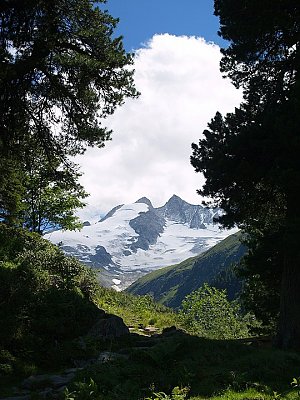
Webcams
(2207 m a.s.l., 6.1 km)
 Krimml: Zillertalarena - Krimmler Tauernhaus
( 9.1 km)
 Krimml: Krimmler Tauernhaus
(1619 m a.s.l., 9.2 km)
 Marktgemeinde Neukirchen am Grossvenediger › East: Kürsingerhütte des österr. Alpenvereins Sektion Salzburg
( 9.5 km)
 Marktgemeinde Neukirchen am Grossvenediger: Kürsingerhütte - Blick nach Süden zum Großen Geiger
(2523 m a.s.l., 9.5 km)

Sun
| today | tomorrow | day after tomorrow | |
|---|---|---|---|
| Dawn: | 6:19 | 6:20 | 6:22 |
| Sunrise: | 6:50 | 6:52 | 6:53 |
| Sunset: | 16:58 | 16:57 | 16:55 |
| Dusk: | 17:30 | 17:28 | 17:27 |