Sexegertenspitze (3424 m a.s.l., Ötztal Alps)
Register and log summit
Weather Sexegertenspitze

About peak Sexegertenspitze
 Rakousko
Vrchol Sexegertenspitze was added here by Milan "Hojší" Průžek and info was completed by Martin Matějka.
https://en.wikipedia.org/wiki/Sexegertenspitze
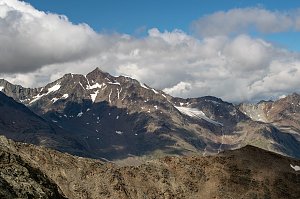
Sexegertenspitze is a twin-summit mountain in the Weisskamm ridge of the Ötztal Alps in the Austrian state of Tyrol. The southern summit has an elevation of 3429 m and the northern summit 3350 m, separated by half a kilometer and a shallow saddle. Both peaks are covered by a glacier.
Ascents
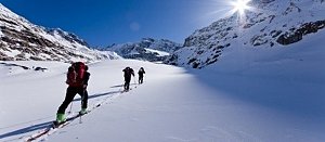
The usual ascents start from the Taschachhaus hut above the Pitztal ski area. These are glacier tours, combined with easy rock climbing in summer and winter. Sexegertenspitze is particularly popular as a ski touring destination, as the snow remains powdery until late spring.
Via the Wannetjoch saddle and on foot along the northwestern ridge – the normal route for summer hiking (5-6 hours).
Via the Sexegertenferner glacier, to the saddle between the northern and southern peaks, and easy climbing to either summit – the safest direction in winter on skis (4-5 hours).
Via the Sexegertenferner glacier and directly up the northeastern ice wall to the northern summit – a steep ski ascent and descent in spring (4 hours).
History
Both the Northern and Southern Sexegertenspitze were first ascended on July 29, 1887, as part of a ridge traverse across Weisskamm. Heinrich Hess and Ludwig Purtscheller traversed from Wildspitze to Hinteren Ölgrubenspitze.
- Chalet/accommodation
-
There is no chalet on the peak.
- Stroller access
-
Peak is not stroller accessible.
- Views
-
There are views from the peak.
- Cable car
-
There is no cable car to this peak.
- Equipment
- Accessibility
-
Peak is freely accessible.
Nearest peaks: Hochvernagtspitze (3539 m, 0.4 km) Nördliche Sexegertenspitze (3348 m, 0.5 km) Hochvernagtwand (3400 m, 0.9 km) Fluchtkogel (3494 m, 2.9 km) Vordere Ölgrubenspitze (3456 m, 3.1 km) Hintergrasleck (3170 m, 3.6 km) Hintergrasleck (3170 m, 3.6 km)
Routes nearby
(elevation gain 1900 m, 20 km)
 Nekonečné roviny Oetztálských Alp na sněžnicích či skialpech
(elevation gain 3500 m, 45 km)

Webcams
( 6.1 km)
 Gemeinde Kaunertal: Kaunertal - Gletscherzentrum
( 6.4 km)
 Gemeinde Kaunertal: Kaunertal - Gletscherzentrum
( 6.4 km)
 Graun - Curon Venosta: Kaunertal - Kaunertaler Gletscherzentrum
( 6.4 km)
 Graun - Curon Venosta: Kaunertal - Karlesjoch
( 8.1 km)
 Maso Corto: Hintereisferner − Blick Richtung Weißkugel und Langtaufererspitze
(3240 m a.s.l., 9.8 km)
 Kurzras - Maso Corto: Hintereisferner - Blick Richtung Hintere Hintereisspitze
(3216 m a.s.l., 9.8 km)

Sun
| today | tomorrow | day after tomorrow | |
|---|---|---|---|
| Dawn: | 7:13 | 7:15 | 7:16 |
| Sunrise: | 7:44 | 7:46 | 7:47 |
| Sunset: | 18:17 | 18:16 | 18:14 |
| Dusk: | 18:48 | 18:47 | 18:45 |