Pańska Skała (920 m a.s.l., Pieniny)
Register and log summit


About peak Pańska Skała
 Polsko
Logged on Vrcholovka 3x in total. Vrchol Pańska Skała was added here by Jiří Králík and info was completed by Rastislav Biarinec.
Part of the Trzy Korony massif. This is the lowest rock of the group. 110 m from the hiking trail. Beautiful views of the valley and the Dunajec River. The summit is relatively easy to access.
You are in a national park, please keep the area clean and do not linger at the summit to avoid it becoming like the adjacent peak, which is already "fenced off with a no entry sign."
- Chalet/accommodation
-
There is no chalet on the peak.
- Stroller access
-
Peak is not stroller accessible.
- Views
-
There are views from the peak.
- Cable car
-
There is no cable car to this peak.
- Equipment
-
No special equipment is required for this summit.
- Accessibility
-
Pieniny National Park - the summit is located off the marked hiking trail.
Nearest peaks: Płaska Skała (950 m, 0.2 km) Trzy Korony (982 m, 0.3 km) Legarkowe Skałki (829 m, 0.4 km) Nad Odródki (940 m, 0.5 km) Łysina (795 m, 0.6 km) Zamkowa Góra (799 m, 0.6 km) Facimiech (668 m, 1.1 km) Czoło (815 m, 1.2 km) Podskalnia Góra (743 m, 1.2 km) Bajków Groń (721 m, 1.3 km) Mała Szutrówka (736 m, 1.3 km) Ociemny Wierch (740 m, 1.3 km) Szutrówka/Białe Skały (749 m, 1.3 km) Bańków (721 m, 1.4 km) Czerteż (774 m, 1.4 km) Czertezik (772 m, 1.4 km) Czoło Z (813 m, 1.5 km) Kláštorná hora (657 m, 1.5 km) Nowa Góra (902 m, 1.6 km) Sokolica (747 m, 1.6 km) Wysoki Dział (731 m, 1.7 km) Klejowa Góra (576 m, 1.8 km) Sylwków Gronik (807 m, 1.8 km) Łupisko (659 m, 1.9 km) Zimna Skała (611 m, 1.9 km) Goła Góra (711 m, 2 km) Przechodni Wierch (552 m, 2 km) Długi Gronik (569 m, 2.1 km) Groń (676 m, 2.1 km) Holica (828 m, 2.1 km) Łączana (818 m, 2.2 km) Obłaźnia Góra (590 m, 2.8 km) Uhliská (600 m, 2.8 km)
Routes nearby
Routes provided by SvetOutdooru.cz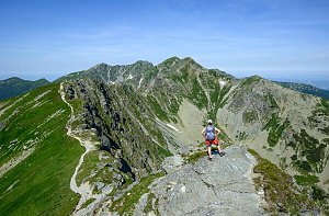


Sun
| today | tomorrow | day after tomorrow | |
|---|---|---|---|
| Dawn: | 5:47 | 5:48 | 5:50 |
| Sunrise: | 6:20 | 6:21 | 6:23 |
| Sunset: | 16:24 | 16:22 | 16:20 |
| Dusk: | 16:57 | 16:55 | 16:53 |