Schober
| Highest peak | Petzeck (3283 m a.s.l.) |
|---|---|
| Most prominent peak | Petzeck (3283 m a.s.l., prominence 799 m) |
| Parent unit | Vysoké Taury |
| Main peaks | Total 36 |
| Most popular peaks | Steinermandl (2213 m a.s.l.), Goiselemandl (2433 m a.s.l.), Glödis (3206 m a.s.l.), Petzeck (3283 m a.s.l.), Schönleitenspitze (2809 m a.s.l.) |
| Mountain range challenges | Austrian Alps |

| Name | Elevation | ||||
|---|---|---|---|---|---|

|
Petzeck | 3283 m a.s.l. | Schober | 799 m | hlavní vrchol |

|
Roter Knopf | 3282 m a.s.l. | Schober | 334 m | hlavní vrchol |
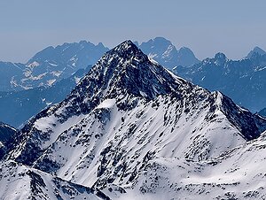
|
Großer Hornkopf | 3251 m a.s.l. | Schober | 452 m | hlavní vrchol |
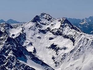
|
Hochschober | 3240 m a.s.l. | Schober | 433 m | hlavní vrchol |

|
Hochschober Wächter | 3208 m a.s.l. | Schober | 7 m | vedlejší vrchol |
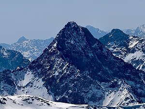
|
Glödis | 3206 m a.s.l. | Schober | 381 m | hlavní vrchol |

|
Kruckelkopf | 3181 m a.s.l. | Schober | 142 m | hlavní vrchol |

|
Großer Friedrichskopf | 3134 m a.s.l. | Schober | 373 m | hlavní vrchol |

|
Hoher Perschitzkopf | 3128 m a.s.l. | Schober | 153 m | hlavní vrchol |
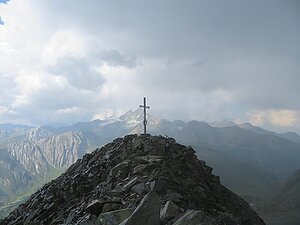
|
Böses Weibl | 3119 m a.s.l. | Schober | 176 m | hlavní vrchol |

|
Kleinschober | 3119 m a.s.l. | Schober | 49 m | hlavní vrchol |

|
Ralfkopf | 3106 m a.s.l. | Schober | 209 m | hlavní vrchol |
|
|
Ganot | 3102 m a.s.l. | Schober | 114 m | hlavní vrchol |

|
Rotspitzen | 3098 m a.s.l. | Schober | 171 m | hlavní vrchol |
|
|
Keeskopf | 3081 m a.s.l. | Schober | 110 m | hlavní vrchol |

|
Hoher Prijakt | 3064 m a.s.l. | Schober | 473 m | hlavní vrchol |
|
|
Debantgrat | 3055 m a.s.l. | Schober | 72 m | hlavní vrchol |

|
Alkuser Rotspitze | 3053 m a.s.l. | Schober | 184 m | hlavní vrchol |
|
|
Debantgrat Südgipfel | 3052 m a.s.l. | Schober | 31 m | hlavní vrchol |
|
|
Niederer Priajkt | 3051 m a.s.l. | Schober | 56 m | hlavní vrchol |
|
|
Tschadinhorn | 3016 m a.s.l. | Schober | 20 m | hlavní vrchol |
|
|
Große Mirnitzspitze | 2985 m a.s.l. | Schober | 48 m | hlavní vrchol |
|
|
Barrenegg | 2952 m a.s.l. | Schober | 53 m | hlavní vrchol |

|
Mulleter Seichenkopf | 2918 m a.s.l. | Schober | 389 m | hlavní vrchol |
|
|
Kleine Mirnitzspitze | 2906 m a.s.l. | Schober | 36 m | hlavní vrchol |
|
|
Kleine Rotspitze | 2869 m a.s.l. | Schober | 14 m | vedlejší vrchol |
|
|
Leibnitzkopf | 2863 m a.s.l. | Schober | 125 m | hlavní vrchol |
|
|
Trelebitschkopf | 2838 m a.s.l. | Schober | 35 m | hlavní vrchol |
|
|
Langes Schöberl | 2820 m a.s.l. | Schober | 33 m | hlavní vrchol |

|
Schönleitenspitze | 2809 m a.s.l. | Schober | 72 m | hlavní vrchol |
|
|
Hintere Rotkofel | 2727 m a.s.l. | Schober | 55 m | hlavní vrchol |
|
|
Rotkofel | 2725 m a.s.l. | Schober | 62 m | hlavní vrchol |
|
|
Mitter Rotkofel | 2715 m a.s.l. | Schober | 14 m | vedlejší vrchol |
|
|
Mirschachskuppe | 2703 m a.s.l. | Schober | 14 m | vedlejší vrchol |
|
|
Nase | 2674 m a.s.l. | Schober | 21 m | hlavní vrchol |
|
|
Barren | 2654 m a.s.l. | Schober | 9 m | vedlejší vrchol |
|
|
Kleines Schöberl | 2593 m a.s.l. | Schober | 26 m | hlavní vrchol |
|
|
Schwarzkofel | 2534 m a.s.l. | Schober | 8 m | vedlejší vrchol |
|
|
Fleckenkopf | 2483 m a.s.l. | Schober | 80 m | hlavní vrchol |
|
|
Gartlkopf | 2458 m a.s.l. | Schober | 13 m | vedlejší vrchol |
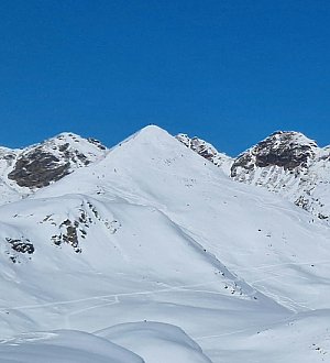
|
Goiselemandl | 2433 m a.s.l. | Schober | 60 m | hlavní vrchol |
|
|
Strasskopf | 2401 m a.s.l. | Schober | 6 m | vedlejší vrchol |
|
|
Steinermandl | 2213 m a.s.l. | Schober | 17 m | hlavní vrchol |
|
|
Staniskas Hochschober | 2185 m a.s.l. | Schober | 25 m | hlavní vrchol |