Pfaffenschneie (3500 m a.s.l., Stubai Alps)
Register and log summit


About peak Pfaffenschneie
 Rakousko
Vrchol Pfaffenschneie was added here by Milan "Hojší" Průžek and info was completed by Milan "Hojší" Průžek.
Since 2021, the summit is adorned with a Madonna by the Stubai artist Hansjörg Ranalter.
Pfaffenschneide is located about 10 km in a straight line southwest of Ranalt in the Stubai Valley and about 8 km northeast of Timmelsjoch. It is bordered by two extensive glaciers. To the northwest, the Pfaffenferner and Sulzenauferner extend up to the ridge height, while the Triebenkarlasferner stretches to the southeast. Neighboring peaks include Zuckerhütl (3505 m) directly to the east, Apere Pfaff at an elevation of 3351 meters to the northwest, and to the southwest, separated by the mountain pass Gamsplatzl (3019 m), lies the 3129-meter-high Gaiskogel.
The route of the first climbers in 1863 led from Mutterbergalm north across Fernauferner to Pfaffenjoch and along the weak northern ridge to the Schneide.
Today's standard route to Pfaffenschneide leads either from the Siegerlandhütte hut to the south at an altitude of 2710 meters or from the Hildesheimer Hütte (2899 m) to the west-northwest. From there, the trail heads southeast to the Gamsplatzl square. It then leads across the Pfaffenferner as a high-altitude hike (only with appropriate equipment and experience) to an altitude of 3230 meters. The ascent has only climbing points in a direct ridge crossing from Gamsplatzl to the 3230 m point with significant difficulty at UIAA grade IV. The walking time from Hildesheimer Hütte to Zuckerhütl is reported in the literature as 3.5 hours, and from Siegerlandhütte as 4.5 hours.
- Chalet/accommodation
-
There is no chalet on the peak.
- Stroller access
-
Peak is not stroller accessible.
- Views
-
There are views from the peak.
- Cable car
-
There is no cable car to this peak.
- Equipment
-
Special equipment is required for this summit.
- Accessibility
-
Peak is freely accessible.
Nearest peaks: Zuckerhütl (3507 m, 0.4 km) Pfaffenkogel (3366 m, 0.5 km) Wilder Pfaff (3456 m, 1.2 km) Wildergrat turm (3259 m, 1.5 km) Sonklarspitze - Cima di Malavalle (3467 m, 1.6 km) Hohes Eis (3434 m, 1.7 km) Steinbockhügel (3215 m, 2.2 km) Coppia Malavalle (3148 m, 2.3 km) Schwarzwandspitz (3358 m, 2.5 km) Aperer Freiger (3252 m, 2.7 km) Hofmannspitze (3113 m, 3 km)
Routes nearby
Routes provided by SvetOutdooru.cz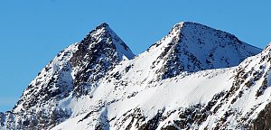

Webcams
(3030 m a.s.l., 1.9 km)
 Mutterbergalm: Stubaier Gletscher Snowpark
(3034 m a.s.l., 1.9 km)
 Gemeinde Solden: Neustift, Stubaier Gletscher - Fernau Bergstation
( 1.9 km)
 Gemeinde Neustift im Stubaital: Neustift, Stubaier Gletscher - Fernau Mittelstation
( 3.2 km)
 Ratschings - Racines: Becherhaus - Blick nach Südosten ins Ridnauntal
( 3.3 km)
 Ratschings - Racines: Übeltalferner | Ghiacciaio di Malavalle - Ridnaun, Südtirol | Val Ridanna, Alto Adige
( 3.3 km)
 Ridnaun - Ridanna: Becherhaus - Blick nach Südosten ins Ridnauntal
( 3.3 km)
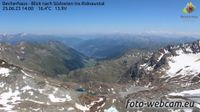 Ratschings: Becherhaus - Blick nach Südwesten
(3110 m a.s.l., 3.3 km)
 Gemeinde Solden: Neustift, Stubaier Gletscher - Schaufeljoch Bergstation
( 3.3 km)
 Gemeinde Neustift im Stubaital: Neustift, Stubaier Gletscher - Eisgrat Bergstation
( 3.7 km)
 Gemeinde Neustift im Stubaital: Neustift, Stubaier Gletscher - Daunjoch
( 4.1 km)
 Gemeinde Neustift im Stubaital: Neustift, Stubaier Gletscher - Murmele Bergstation
( 4.6 km)
Sun
| today | tomorrow | day after tomorrow | |
|---|---|---|---|
| Dawn: | 6:16 | 6:17 | 6:19 |
| Sunrise: | 6:47 | 6:49 | 6:50 |
| Sunset: | 17:11 | 17:09 | 17:07 |
| Dusk: | 17:42 | 17:40 | 17:39 |