Westliche Simonyspitze (3473 m a.s.l., Venediger)
Register and log summit


About peak Westliche Simonyspitze
 Rakousko
Vrchol Westliche Simonyspitze was added here by Milan "Hojší" Průžek.
https://en.wikipedia.org/wiki/Westliche_Simonyspitze
Westliche Simonyspitze (3,473 m) is a mountain in the Hohe Tauern range in Austria. It is located in the Venediger group on the border between Tyrol and Salzburg. It lies on the Tauernhauptkamm ridge between the peaks of Östliche Simonyspitze (3,448 m) to the northeast and Umbalköpfl (3,429 m) to the southwest. A ridge extends southward from the main ridge, with the first prominent peak being Hintere Gubachspitze (3,387 m). The northwestern slopes of the mountain are home to the Krimmlerkees glacier, which flows into the upper part of the Krimmler Achental valley, while the southeastern slopes feature the Simonykees glacier, flowing into the upper part of the Maurertal valley. The mountain was named in honor of the Austrian geographer Friedrich Simony.
The first ascent was made on July 28, 1871, by Stuttgart climber Theodor Harpprecht, accompanied by mountain guide Josef Schnell.
The summit can be reached, for example, from the Kleine-Philipp-Reuter-Hütte (2,677 m) via the Umbalkees glacier. This is a glacial tour rated at difficulty level II.
- Chalet/accommodation
-
There is no chalet on the peak.
- Stroller access
-
Peak is not stroller accessible.
- Views
-
There are views from the peak.
- Cable car
-
There is no cable car to this peak.
- Equipment
- Accessibility
-
Peak is freely accessible.
Nearest peaks: Östliche Simonyspitze (3442 m, 0.6 km) Umbalköpfl (3426 m, 1 km) Dreiherrnspitze (3499 m, 1.6 km) Malhamspitze (3373 m, 2.6 km) Rostocker Eck (2749 m, 3.2 km)
Routes nearby
(elevation gain 1100 m, 15 km)
 Výstup na Grossvenediger (3666 m) normálkou přes Defreggerhaus
(elevation gain 2500 m, 30 km)
 Adlerweg - Orlí stezka napříč Tyrolskem
(elevation gain 8000 m, 90 km)
Mountain chalets
Webcams
(2207 m a.s.l., 3.4 km)
 Marktgemeinde Neukirchen am Grossvenediger › East: Kürsingerhütte des österr. Alpenvereins Sektion Salzburg
( 6.2 km)
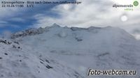 Marktgemeinde Neukirchen am Grossvenediger: Kürsingerhütte - Blick nach Süden zum Großen Geiger
(2523 m a.s.l., 6.2 km)

Sun
| today | tomorrow | day after tomorrow | |
|---|---|---|---|
| Dawn: | 6:15 | 6:16 | 6:17 |
| Sunrise: | 6:46 | 6:47 | 6:49 |
| Sunset: | 17:03 | 17:01 | 16:59 |
| Dusk: | 17:34 | 17:33 | 17:31 |