





Climbing
po, 12.6.2023, 13:30
 Rakousko
Logged on Vrcholovka 1x in total. Vrchol Niederer Dachstein was added here by Nohy na stole and info was completed by Martin Matějka a Jiří Králík.
Help others and .
There is no chalet on the peak.
Peak is not stroller accessible.
There are views from the peak.
There is no cable car to this peak.
No special equipment is required for this summit.
Peak is freely accessible.
Nearest peaks: Hoher Dachstein (2995 m, 0.4 km) Dachsteinwarte (2741 m, 0.7 km) Hinkelstein (2775 m, 0.8 km) Mitterspitz (2925 m, 0.9 km) Westliches Dirndl (2832 m, 1 km) Hohes Kreuz (2837 m, 1.1 km) Mitterstein (2097 m, 1.1 km) Östliches Dirndl (2818 m, 1.1 km) Torstein (2948 m, 1.6 km) Kleiner Gjaidstein (2734 m, 1.7 km) Niederes Kreuz (2651 m, 1.8 km) Hunerkogel (2687 m, 1.9 km) Hoher Gjaidstein (2794 m, 2 km) Raucheck (2189 m, 2.2 km) Schöberl (2426 m, 2.3 km) Schönbühel (1830 m, 2.3 km) Kleiner Koppenkarstein (2831 m, 2.6 km) Hoher Ochsenkogel (2527 m, 2.7 km) Niederer (2364 m, 3.2 km)
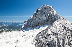 Vrchol Dachsteinu z Hallstattu
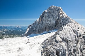 Dachstein z jihu od Ramsau
Okruh po horských chatách kolem Dachsteinu
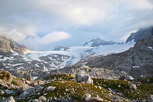 Okruh přes Hoher Dachstein
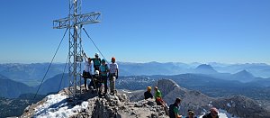
 Ramsau am Dachstein: Hauser Kaibling - Schladming - Dachstein
 Ramsau am Dachstein: Hauser Kaibling - Schladming - Dachstein
 Ramsau am Dachstein: Hauser Kaibling - Schladming - Dachstein
 Schildlehen: Hauser Kaibling − Schladming − Dachstein
 Schildlehen: Hauser Kaibling − Schladming − Dachstein
 Obertraun: Ramsau a. D. - Dachstein
 Schladming: Bergstation Dachstein Hunerkogel
 Hallstatt: Dachstein - Simonyhütte - Blick zum Hallstättergletscher
 Hallstatt › South: Hallstätter Glacier
 Hallstatt › South-West
 Hallstatt › North-West
 Hallstatt › North-West
 Gosau: Hinterer Gosausee
 Ramsau am Dachstein: Ramsau - Lindenhof - Ramsbergerhof - Blick zum Dachstein
 Ramsau: Rittisberg in − am Dachstein
 Ramsau: am Dachstein

| today | tomorrow | day after tomorrow | |
|---|---|---|---|
| Dawn: | 7:05 | 6:07 | 6:08 |
| Sunrise: | 7:37 | 6:38 | 6:40 |
| Sunset: | 18:02 | 17:00 | 16:58 |
| Dusk: | 18:33 | 17:31 | 17:30 |