






Hiking
čt, 9.7.2026, 11:10
 Rakousko
Logged on Vrcholovka 1x in total. Vrchol Vorderer Brochkogel was added here by Milan "Hojší" Průžek.
Vorderer Brochkogel is part of challenges: Austrian Alps, TOP 10 Austria
Hinterer Brochkogel (3628 m) is the third highest peak of the Weißkamm mountain range in the Ötztal Alps, in the Austrian state of Tyrol. Its summit is entirely covered by a glacier. To the south, separated by the Vernagtjoch mountain pass (3400 m), lies the 3565-meter-high Vorderer Brochkogel.
The first ascent of Hinterer Brochkogel was achieved on August 2, 1858, by mountain guide Leander Klotz and tourist Albert Wachtler.
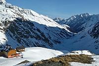
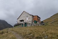
The normal route, the easiest ascent, to Hinterer Brochkogel is a high-altitude hike requiring appropriate equipment, leading over the southern ridge. The starting point is the Breslauer Hütte mountain hut (2844 m, west of Vent at the foot of Wildspitze, usually open from late June to late September, 62 beds, 110 mattresses, 40 emergency mattresses, and 22 mattresses in the winter refuge). Other waypoints include the Taschachhaus mountain hut (2434 m, in the Pitztal valley, usually open from mid-June to late September, 38 beds, 87 mattresses, and 28 mattresses in the winter refuge), Vernagthütte (2755 m, in the back of the Rofental valley in the Weißkamm range, usually open from early June to mid-September, 52 beds, 77 mattresses, and 22 mattresses in the winter refuge), and Braunschweiger Hütte (2759 m, in the furthest part of the Pitztal valley, usually open from mid-June to late September, 56 beds, 127 mattresses, 15 emergency mattresses, and 11 mattresses in the winter refuge).
There is no chalet on the peak.
Peak is not stroller accessible.
There are views from the peak.
There is no cable car to this peak.
Special equipment is required for this summit.
Peak is freely accessible.
Nearest peaks: Hinterer Brochkogel (3635 m, 1.3 km) Wildspitze (3768 m, 1.7 km) Wildspitze (Nordgipfel) (3765 m, 1.8 km) Urkundkolm (3134 m, 1.9 km) Kreuzerschneide (3677 m, 2.2 km) Schluchtkogel (3472 m, 3.2 km)
 Nekonečné roviny Oetztálských Alp na sněžnicích či skialpech
 Výstup na Similaun s návratem přes sedlo Hauslabjoch a soutěsku Rofen
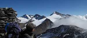 Přechod Mainzer Höhenweg
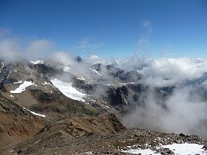 Výstup na bělostný vrchol Palla Bianca neboli Weisskugel

| today | tomorrow | day after tomorrow | |
|---|---|---|---|
| Dawn: | 7:13 | 7:14 | 7:16 |
| Sunrise: | 7:44 | 7:45 | 7:47 |
| Sunset: | 18:17 | 18:15 | 18:14 |
| Dusk: | 18:48 | 18:46 | 18:45 |