




Hiking, 20 km
9.7.2026
 Švýcarsko
Logged on Vrcholovka 9x in total. Vrchol Klein Allalin was added here by Martin Horáček and info was completed by Jiří Králík.
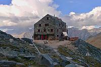
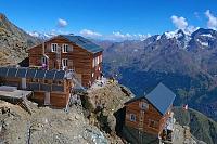
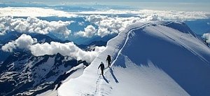
Klein Allalin is a small peak next to the Britannia hut (3,030 m). It offers a great view of the Mischabel group (Dürrenhorn, Nadelhorn, Lenzspitze, Dom, Täschhorn), Strahlhorn, Rimpfischhorn, and Allalinhorn. You can see the climbing routes to Strahlhorn and Rimpfischhorn (normal route) and to Allalinhorn via the Hohllaub ridge. You also have a fantastic view of the Mattmark reservoir, the Monte Moro pass, and Stelihorn. On the other side of the valley, you have a great view of Weissmies and its complete ascent via the JJV ridge to Lagginhorn, Fletschhorn, and Jegihorn. In the distance, you can see the Bernese Alps.
Photo: Jiří Králík
Britannia hut
Only suitable for off-road driving.
There are views from the peak.
There is no cable car to this peak.
No special equipment is required for this summit.
Peak is freely accessible.
Nearest peaks: Chessjen (2971 m, 0.4 km) Hinterallalin turm (3185 m, 0.5 km) Kleiner Hinterallalin (3250 m, 0.9 km) Hinterallalin (3331 m, 1.4 km) Egginer (3367 m, 1.8 km) Schwarzbergschopf (2870 m, 1.8 km) Üssere Turu (3030 m, 2 km) Mittagturm (3161 m, 2.6 km) Mittaghorn (3143 m, 2.8 km)
 Hohlaubgrat na Allalinhorn - úchvatný hřeben na klasickou čtyřtisícovku
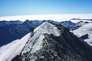 Výstup hřebenem Nadelgrat přes čtyřtisícovky Stecknadelhorn, Dürrenhorn a Nadelhorn
Traverz tří Walliských klenotů – Alphubel – Täschhorn – Dom
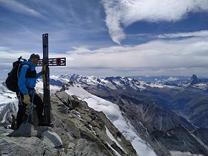 Výstup normálkou na Weissmies ve Walliských Alpách
Výstup na čtyřku Weissmies středněnáročnou trasou přes jihovýchodní hřeben
 Lezecký výstup na Weissmies severním hřebenem
 Saas-Almagell: Staumauer Mattmark
 Saas-Almagell: Allalingletscher
 Zermeiggern: Heidbodme
 Saas-Fee: Mitelallalin - Allalin
 Saas-Fee: Mittelallalin
 Saas-Fee: Mittelallalin
 Saas-Fee: Mittelallalin
 Saas-Fee: Mittelallalin
 Saas-Fee: Mittelallalin - Allalin
 Saas-Fee: Mittelallalin
 Zermeiggern: Heidbodme
 Saas-Almagell: Heidbodme
 Saas-Almagell: Heidbodme
 Saas-Almagell: Heidbodme
 Saas-Almagell: Heidbodme
 Saas-Fee › East: Längflue
 Saas-Fee: Längfluh Berg
 Saas-Fee: Längfluh
 Saas-Fee › North: Längflue
 Saas-Almagell: Hotel Kristall-Saphir
 Saas-Fee: Dorf
 Saas-Fee: Saas Fee − Blick vom Tourismusbüro
 Saas-Fee › South-West: Saas Fee - Allalinhorn
 Saas-Fee: Saas Fee
 Hannigalp: Restaurant Hannig Bergrestaurant
 Saas-Fee: Hannig
 Saas-Fee: Hannig
 Saas-Fee: Hannig
 Saas-Fee: Hannig

| today | tomorrow | day after tomorrow | |
|---|---|---|---|
| Dawn: | 7:25 | 7:27 | 6:28 |
| Sunrise: | 7:56 | 7:57 | 6:59 |
| Sunset: | 18:28 | 18:27 | 17:25 |
| Dusk: | 18:59 | 18:57 | 17:56 |












