

Hiking, 2 km
14.8.2026
 Itálie
Logged on Vrcholovka 4x in total. Významný bod Passo dello Stelvio was added here by Jirka Hruška.
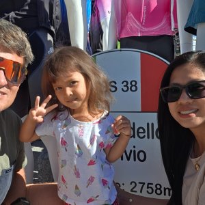
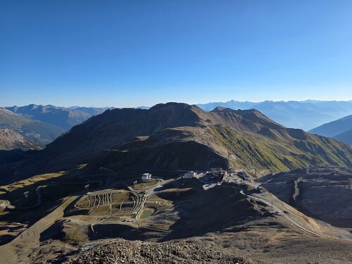
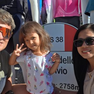
Passo dello Stelvio is a mountain pass in the Rhaetian Alps, the highest in Italy and the second highest in Europe, located between Trentino-Alto Adige and Lombardy, within the Stelvio National Park. It is an important connection between Valtellina and Val Venosta, a destination for skiers, hikers, cyclists, and motorcyclists. The state road that runs through it, from Bormio to Prato allo Stelvio, is paved, two-lane, and has eighty-eight hairpin turns. The pass is seasonally closed from November to May, and hiking trails branch out from the summit. The road was built between 1818 and 1825 and was commissioned by Emperor Francis II of Habsburg to engineer Carlo Donegani. During World War I, clashes occurred here between Italians and Austrians, who built fortifications in the area. In 1928, the road was paved and widened. The pass is a historic climb in cycling, often included in the Giro d'Italia, and is the venue for amateur cycling races and the Stelvio Marathon.
There is a chalet on the peak.
This peak is accessible with a stroller.
There are views from the peak.
A cable car goes to this peak.
No special equipment is required for this summit.
Peak is freely accessible.
Nearest peaks: Dreisprachenspitze (2843 m, 0.2 km) Monte Scorluzzino (3000 m, 0.8 km) Monte Scorluzzo (3094 m, 1.1 km) Piz Cotschen - Punta Rosa (3026 m, 1.5 km) Naglerspitz (3252 m, 2 km) Punta del Naso (3272 m, 2.3 km)
 Vysokohorská hřebenovka Monte Cevedale - Monte Vioza s možným výstupem na Gran Zebrú
Legendárním Hintergratem na Ortler
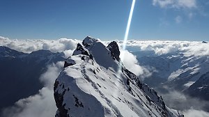 Sněžnicový přechod švýcarské krajiny cestou ze Scuolu přes S-Charl až do Lü
 Stilfs - Stelvio: Strada
 Stilfs - Stelvio: Terrazza Pirovano
 Stilfs: Passo dello − Dal Pirovano, uno sguardo verso l'orizzonte
 Bormio
 Stilfs - Stelvio: Passo dello
 Passo Stelvio - Stilfserjoch › North-west
 Stilfs - Stelvio: Stilfser Joch - Tibet Hütte
 Grand'Albergo: Passo Stelvio Ost
 Grand'Albergo: Stelvio
 Stilfs - Stelvio › North-west: Mittelstation Trincerone - Ghiacciaio del Livrio - Ski-area Passo dello Stelvio
 Stilfs - Stelvio: LIVRIO - Passo - PISTE sci estivo
 Stilfs - Stelvio › North-west: Passo dello Stelvio
 Grand'Albergo: Stelvio
 Grand'Albergo: Stelvio
 Grand'Albergo: Stelvio
 Stilfs - Stelvio: Passo - Hotel Livrio
 Passo Stelvio: Stelvio − Passo dello Stelvio
 Passo Stelvio: Stelvio − Passo dello Stelvio
 Passo Stelvio: Stelvio − Passo dello Stelvio
 Trafoi › South-East: Ortler
 Stilfs - Stelvio: Trafoi - Furkelhütte
 Trafoi: Blick nach Süden zum Ortler

| today | tomorrow | day after tomorrow | |
|---|---|---|---|
| Dawn: | 6:22 | 6:24 | 6:25 |
| Sunrise: | 6:54 | 6:55 | 6:56 |
| Sunset: | 17:09 | 17:08 | 17:06 |
| Dusk: | 17:40 | 17:39 | 17:37 |