Steinfleckberg (1342 m a.s.l., Šumava)
Register and log summit

About peak Steinfleckberg
 Německo
Logged on Vrcholovka 8x in total. Vrchol Steinfleckberg was added here by Vladimír Grančay and info was completed by Martin Matějka, Vladimír Grančay a Krtek.
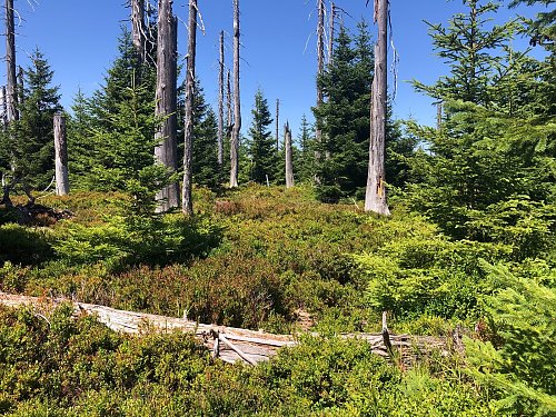
The summit is accessible in 2025 from July 15 to November 15 via trails marked on maps. The journey around the peak is an experience. From the highest point of the trail (Kapellenweg), an indistinct path leads to a nearby summit. The highest plateau is overgrown, and the highest point cannot be identified. The summit has no views, but the circular route offers amazing vistas.
- Chalet/accommodation
-
There is no chalet on the peak.
- Stroller access
-
Peak is not stroller accessible.
- Views
-
There are views from the peak.
- Cable car
-
There is no cable car to this peak.
- Equipment
-
No special equipment is required for this summit.
- Accessibility
-
Core area in the Bavarian Forest National Park
Nearest peaks: Velká Mokrůvka (1370 m, 1.2 km) Farrenberg (1203 m, 1.5 km) Drei Zwerge (1254 m, 1.6 km) Hoher Filzberg (1279 m, 1.8 km) Markkopf (1280 m, 1.8 km) Luzný / Lusen (1373 m, 1.9 km) Malá Mokrůvka (1331 m, 2.2 km) Lusen Z (1253 m, 2.5 km) Sulzriegel (1257 m, 2.8 km) Hochgefeichtetstein (1260 m, 3.3 km) Černá hora (1316 m, 3.6 km)
Routes nearby
Routes provided by SvetOutdooru.cz
Webcams
(1166 m a.s.l., 3.6 km)
 Finsterau: bei Langlaufstadion
(1031 m a.s.l., 4.1 km)

Sun
| today | tomorrow | day after tomorrow | |
|---|---|---|---|
| Dawn: | 7:08 | 6:09 | 6:11 |
| Sunrise: | 7:40 | 6:41 | 6:43 |
| Sunset: | 17:59 | 16:58 | 16:56 |
| Dusk: | 18:32 | 17:30 | 17:28 |