Hinterer Tajakopf (2408 m a.s.l., Mieming Kette)
Register and log summit
Weather Hinterer Tajakopf

About peak Hinterer Tajakopf
 Rakousko
Vrchol Hinterer Tajakopf was added here by Jan Blažej and info was completed by Jan Blažej.
Help others and .
- Chalet/accommodation
-
There is no chalet on the peak.
- Stroller access
-
Peak is not stroller accessible.
- Views
-
There are views from the peak.
- Cable car
-
There is no cable car to this peak.
- Equipment
-
The route to the summit can also be partially done via a via ferrata of difficulty E, so a ferrata set is recommended for the brave.
- Accessibility
-
Peak is freely accessible.
Nearest peaks: Vorderer Tajakopf (2450 m, 0.4 km) Vorderer Drachenkopf (2303 m, 1.7 km) Sonnenspitze (2417 m, 2.2 km) Sonnenspitze (2417 m, 2.2 km) Wankspitze (2216 m, 2.5 km)
Routes nearby
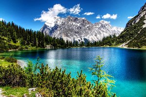 Výstup na Zugspitze z rakouské strany
(elevation gain 2000 m, )
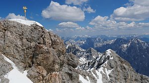 Hřebenový přechod Zugspitze – Alpspitze (Jubiläusgratweg)
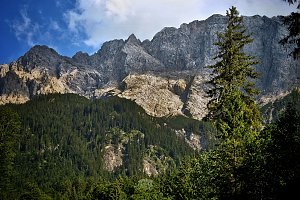 Výstup na Zugspitze feratou Höllental
(elevation gain 2800 m, 20 km)
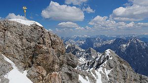 Výstup na Zugspitze oklikou přes Reintalangerhütte
(elevation gain 4200 m, 36 km)
Webcams
(1919 m a.s.l., 1.1 km)
 Gemeinde Ehrwald: Ehrwald - Almbahn
(1485 m a.s.l., 3 km)
 Gemeinde Ehrwald: Ehrwald, Zugspitze - Ehrwalder Alm
( 3.1 km)
 Gemeinde Mieming: Ehrwald, Zugspitze - Feldernalm
( 4 km)
 Gemeinde Mieming: Ehrwald, Zugspitze - Feldernalm
( 4 km)
 Gemeinde Mieming: Ehrwald, Zugspitze - Feldernalm
( 4 km)
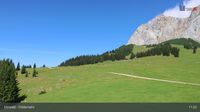 Gemeinde Ehrwald: Ehrwald, Zugspitze - Feldernalm
( 4 km)
 Gemeinde Biberwier: Biberwier, Marienberg - DSB Berg Biberwier
( 4.2 km)
 Gemeinde Ehrwald: Wettersteinbahnen Ehrwald
( 4.6 km)
 Gemeinde Biberwier: Biberwier, Marienberg - Talstation Marienberg
( 4.6 km)
 Gemeinde Ehrwald: Ehrwald - Sonnenhangbahn Bergstation
( 4.8 km)
 Gemeinde Ehrwald: Ehrwalder Wettersteinbahnen - Sonnenhangbahn Bergstation
(1282 m a.s.l., 4.8 km)
 Ehrwald
(1043 m a.s.l., 5.2 km)
 Gemeinde Ehrwald: Ehrwalder Wettersteinbahnen - Racing-S-Wettersteinabfahrt-Bärengrubenabfahrt
( 5.2 km)
 Gemeinde Ehrwald: Ehrwalder Wettersteinbahnen - Weißlähn
(1363 m a.s.l., 5.6 km)
 Gemeinde Ehrwald: Ehrwald - Weißlähn
( 5.6 km)
 Gemeinde Lermoos: Ehrwald-Lermoos - Golfclub Zugspitze
(966 m a.s.l., 5.8 km)
 Gemeinde Ehrwald: Ehrwald, Zugspitze - Tiroler Zugspitze Golf-Anlage
( 5.8 km)
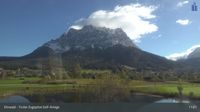 Gemeinde Ehrwald: Ehrwald, Zugspitze - Tiroler Zugspitze Golf-Anlage
( 5.8 km)
 Gemeinde Ehrwald: Ehrwald, Zugspitze - Tiroler Zugspitze Golf-Anlage
( 5.8 km)
 Grainau: Ehrwald, Zugspitze - Tiroler Zugspitze Golf-Anlage
( 5.8 km)
 Gemeinde Ehrwald: Ehrwald, Zugspitze - Tiroler Zugspitze Golf-Anlage
( 5.8 km)
 Ehrwald: Wettersteinbahnen
(1259 m a.s.l., 6 km)
 Gemeinde Ehrwald: Wettersteinbahnen Ehrwald
( 6 km)
 Gemeinde Ehrwald › East: Zugspitze
( 6 km)
 Garmisch-Partenkirchen: Sonnalpin - Gletscher-Skigebiet Zugspitze - Blick zum Schneefernerkopf
(2582 m a.s.l., 6.4 km)
 Gemeinde Mieming: Mieminger Plateau - Alpenresort Schwarz
(880 m a.s.l., 6.5 km)

Sun
| today | tomorrow | day after tomorrow | |
|---|---|---|---|
| Dawn: | 6:20 | 6:22 | 6:23 |
| Sunrise: | 6:52 | 6:53 | 6:55 |
| Sunset: | 17:07 | 17:06 | 17:04 |
| Dusk: | 17:39 | 17:37 | 17:36 |