
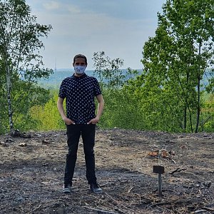

Hiking
so, 9.5.2020, 15:53


 Česko
Logged on Vrcholovka 1x in total. Vrchol Halda Heřmanice was added here by Luke.
Halda Heřmanice is an artificial hill created by piling up waste from the Heřmanice Mine, located in the Slezská Ostrava district of Ostrava. The hill is bordered to the northwest by the Ostrava - Bohumín railway line, to the east by Heřmanický pond, and to the south by the Advanced World Transport railway line from Ostrava main station to Rychvald and the Heřmanice freight yard. Enter at your own risk.
There is no chalet on the peak.
Peak is not stroller accessible.
There are views from the peak.
There is no cable car to this peak.
No special equipment is required for this summit.
Nearest peaks: Halda Heřmanice (270 m, 0 km) Hrušovská halda (232 m, 1.6 km) Halda Hubert (231 m, 2 km) Halda Malá Ema (306 m, 2.9 km) Halda Ema (315 m, 3.1 km)
| today | tomorrow | day after tomorrow | |
|---|---|---|---|
| Dawn: | 5:56 | 5:57 | 5:59 |
| Sunrise: | 6:29 | 6:31 | 6:32 |
| Sunset: | 16:31 | 16:29 | 16:28 |
| Dusk: | 17:04 | 17:03 | 17:01 |