

Hiking, 14 km
6.10.2026
 Česko
 Polsko
Trutnov (Královéhradecký kraj)
Logged on Vrcholovka 1022x in total. Peak information here was completed by Eva Gulišová, Honza, Pája, Alexandr Starý a Martin Matějka.
Sněžka is part of challenges: Cross on the Summit of Domestic Mountains and Hills, Crown of Czechia, Crown of Mountains Poland, Crown of Regions and Districts, Crown of the Border Mountains, Extreme Peaks of the Czech Republic, Geological Crown of the Czech Republic, Highest Geographical Points of Europe, Highest Mountains of European Countries, Highest Peaks of All Regions of the Czech Republic, Koruna Sudet, Most Isolated, The Highest Mountains of Hradec Králové Region, The Highest Peaks of Visegrád, The Most Prominent Mountains of the Czech Republic, Thousanders of the Czech Republic, Tisícovky Krkonoš, Ultrapeaks, Via Czechia Severní stezka
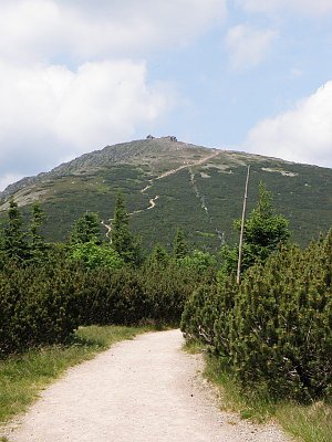
Sněžka (in Polish Śnieżka, in German Schneekoppe) is the highest mountain of the border (Silesian) ridge of the Krkonoš, Sudetes, Czech Highlands, Bohemia, and all of Czechia and Silesia, with an elevation of 1603.30 m above sea level (the previously stated height of 1602 m is the elevation of the trigonometrical point).
It is a significant landmark in the eastern part of the Krkonoš. The Czech-Polish border runs over the summit of Sněžka, with the highest point located on the Polish side of the border, a few meters west of the St. Lawrence Chapel. A cable car leads to the summit from Pec pod Sněžkou, which is 4.5 km away. The northern, Polish side descends into the valley of the Lomnice River, the western side into the Úpa peat bog, the southwestern part into the Obří Důl, the southeastern into the valley of the Jelení Potok, and the eastern transitions into the Obří Ridge.
The summit is rocky and covers an area of about 120,000 m². As Sněžka is the highest mountain in the surrounding area, it offers extensive panoramic views from the top. The summit is a frequent tourist destination, and there are numerous hiking trails available for reaching it, including footpaths, cycling routes, and cross-country skiing trails.
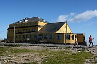
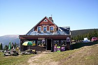
There is a chalet on the peak.
Peak is not stroller accessible.
There are views from the peak.
A cable car goes to this peak.
No special equipment is required for this summit.
Peak is freely accessible.
Nearest peaks: Kopa (1377 m, 1.3 km) Růžová hora (1393 m, 1.7 km) Nad Spalonou Strażnicou (1443 m, 1.9 km) Turek (1003 m, 3.6 km) Lesní hora (1129 m, 3.7 km)
 Pec pod Snezkou: ŚNIEŻKA
 Sněžka
 Mala Upa: Sněžka - lanovka
 Mala Upa: Sněžka - lanovka
 Sněžka, pohled na Studniční horu
 Pec pod Snezkou: Krkonoše, Sněžka, nová lanovka (pohled na jih)
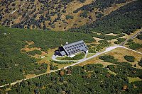
 Karpacz › East: Dom Śląski Karpacz
 Karpacz: Kopa
 Karpacz › North: Kopa Chairlift Top Station
 Borowice › North: Karpacz - Giant Mountains
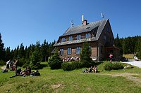
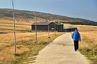
 Borowice: Schronisko Samotnia, Karpacz
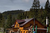
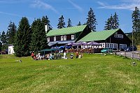
 Pec pod Snezkou: Krkonoše - Luční bouda (pohled na boudu se sezením)
 Pec pod Snezkou › East: Luční bouda - Královéhradecký kraj, Česko
 Pec pod Snezkou › North
 Pec pod Snezkou: Bobová dráha
 Pec pod Snezkou: Velká Úpa - Velká Úpa, POI 1
 Karpacz
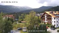 Karpacz: Sněžka
 Karpacz
 Karpacz
 Karpacz
 Pec pod Snezkou › West: HOTELHORIZONT
 Karpacz Gorny: Karpacz - stok Maciuś NOWOŚĆ
 Ploczki: złota jesień - NOWOŚĆ
 Karpacz › South-west
 Karpacz: Kopa
 Karpacz: Świątynia Wang 2
 Pec pod Snezkou: Javor
 Pec pod Snezkou: Javor
 Pec pod Snezkou › East: Cerná Hora
 Pec pod Snezkou: Schneekope
 Pec pod Snezkou: Schneekope

| today | tomorrow | day after tomorrow | |
|---|---|---|---|
| Dawn: | 7:01 | 6:02 | 6:04 |
| Sunrise: | 7:34 | 6:36 | 6:38 |
| Sunset: | 17:47 | 16:45 | 16:43 |
| Dusk: | 18:21 | 17:19 | 17:17 |