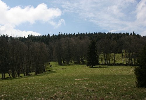
Above the Back Forest Z (1044 m a.s.l., Šumava)
Register and log summit

About peak Above the Back Forest Z
 Česko
Český Krumlov (Jihočeský kraj)
Logged on Vrcholovka 2x in total. Vrchol Above the Back Forest Z was added here by Bouřka and info was completed by Martin Matějka.
Slightly higher than the nearby official secondary thousand-meter peak Nad Zadním Borem. According to the ČÚZK map, it measures 1044.3 m and the geodetic point on the eastern peak is 1043.7 m.
- Chalet/accommodation
-
There is no chalet on the peak.
- Stroller access
-
Peak is not stroller accessible.
- Views
-
There are no views from the peak.
- Cable car
-
There is no cable car to this peak.
- Equipment
-
No special equipment is required for this summit.
- Accessibility
-
Boletice Military District.
Nearest peaks: Nad Zadním Borem (1044 m, 0.2 km) Lysá (1228 m, 1.1 km) Zlatovec J (1009 m, 1.1 km) Lysá J (1133 m, 1.4 km) Na Skalce (963 m, 1.4 km) Krb JZ (1075 m, 1.6 km) Zlatovec (1042 m, 1.6 km) Lysá Z (1192 m, 1.7 km) Nad Vískou JV2 (1031 m, 1.8 km) Bald NW (1140 m, 1.9 km) Kamenitý vrch (1039 m, 2 km) Jilmový les (970 m, 2.1 km) Nad Vískou JV1 (1047 m, 2.1 km) Knížecí stolec (1236 m, 2.2 km) Nad Račínem (953 m, 2.2 km) Nad Novým Špičákem (1084 m, 2.3 km) Nad Vískou (1053 m, 2.3 km) Nad Vískou SZ (1043 m, 2.4 km) Nad Žumberskou cestou (1110 m, 2.4 km) Under Žumberská Path (1033 m, 3.2 km) Špičák S (1076 m, 3.3 km) U Dolnošpičácké cesty (949 m, 3.3 km)
Routes nearby
(elevation gain 10400 m, 1051 km)
 Přechod NP Šumava
(elevation gain 2456 m, 101 km)

Sun
| today | tomorrow | day after tomorrow | |
|---|---|---|---|
| Dawn: | 6:13 | 6:14 | 6:16 |
| Sunrise: | 6:45 | 6:47 | 6:49 |
| Sunset: | 16:49 | 16:47 | 16:45 |
| Dusk: | 17:21 | 17:20 | 17:18 |