Kamenitý vrch (1039 m a.s.l., Šumava)
Register and log summit


About peak Kamenitý vrch
 Česko
Český Krumlov (Jihočeský kraj)
Logged on Vrcholovka 9x in total. Peak information here was completed by Pavel Martínek, Martin Matějka, Bouřka a Vladimír Grančay.
Kamenitý vrch is part of challenges: Šumavské tisícovky, The Highest Peaks of South Bohemia, Thousanders of the Czech Republic
Rocky peak 6 km south of Markov. It lies at the end of a side southeast ridge extending from the thousand-meter peak Nad Vískou. In the highest part, there is a tall rock, with numerous scree fields and streams, especially to the east, flowing into the Olšina valley. There is a geodetic point at the summit. (tisicovky.cz)
- Chalet/accommodation
-
There is no chalet on the peak.
- Stroller access
-
Peak is not stroller accessible.
- Views
-
There are no views from the peak.
- Cable car
-
There is no cable car to this peak.
- Equipment
-
No special equipment is required for this summit.
- Accessibility
-
Part of the VVP Boletice.
Nearest peaks: Nad Vískou JV2 (1031 m, 0.6 km) Nad Myslivnou JZ (999 m, 0.8 km) Na Skalce (963 m, 1.1 km) Alfenberg (988 m, 1.2 km) Nad Myslivnou (1006 m, 1.2 km) Nad Račínem (953 m, 1.2 km) Nad Vískou JV1 (1047 m, 1.3 km) Kmet (997 m, 1.6 km) Nad Myslivnou S (1004 m, 1.7 km) U kostela (1010 m, 1.8 km) Nad Zadním Borem (1044 m, 1.9 km) Nad Zadním Borem Z (1044 m, 2 km) Kmet J (940 m, 2.1 km) Zlatovec J (1009 m, 2.1 km) Nad Vískou (1053 m, 2.2 km) Kmet V (897 m, 2.3 km) Nad Vískou SZ (1043 m, 2.6 km) Zlatovec (1042 m, 2.6 km) U Dolnošpičácké cesty (949 m, 3.4 km)
Routes nearby
Routes provided by SvetOutdooru.cz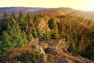
Sun
| today | tomorrow | day after tomorrow | |
|---|---|---|---|
| Dawn: | 6:07 | 6:08 | 6:10 |
| Sunrise: | 6:39 | 6:41 | 6:42 |
| Sunset: | 16:55 | 16:54 | 16:52 |
| Dusk: | 17:28 | 17:26 | 17:24 |