Boubínské jezírko (925 m a.s.l., Boubínská pahorkatina)



About peak Boubínské jezírko
 Česko
Logged on Vrcholovka 2x in total. Vrchol Boubínské jezírko was added here by Kris.
It is located on the Kaplický stream, on the southern slope of Boubín at an altitude of 925 m. It has an area of 0.37 ha and a maximum depth (at the outlet) of 4 m.
On the dam of the lake, there is a hut for the guardians of the Boubínský prales national nature reserve, benches with tables for visitors, and the educational trail around the core of Boubínský prales begins here.
It was built in 1833 as a floating reservoir to enhance the flow and for better timber rafting from the Boubín forests to Idina Pilu and to the glassworks in Lenora by temporarily intensively releasing accumulated water during rafting. Timber was still being floated here in 1957.
- Chalet/accommodation
-
There is no chalet on the peak.
- Stroller access
-
Peak is not stroller accessible.
- Views
-
There are no views from the peak.
- Cable car
-
There is no cable car to this peak.
- Equipment
-
No special equipment is required for this summit.
- Accessibility
-
Peak is freely accessible.
Nearest peaks: Větřín (1178 m, 1.3 km) Basumský hřeben (1290 m, 1.7 km) Basumský hřeben S (1290 m, 1.7 km) Boubín (1362 m, 1.9 km) Solovec JZ (1143 m, 1.9 km) Pažení (1281 m, 2.1 km) Srní vrch (1298 m, 2.1 km) Červený vrch (1203 m, 2.2 km) Pažení J (1229 m, 2.2 km) Srní hlava (1269 m, 2.2 km) Trojmezí (1094 m, 2.5 km) Jilmová skála (1037 m, 2.7 km) Medvědí hrb (969 m, 2.9 km) Zátoňská hora S (1032 m, 3 km) Zátoňská hora SV (1018 m, 3 km) Zátoňská hora (1039 m, 3.2 km) Palečkovský vrch (1014 m, 3.7 km)
Routes nearby
Routes provided by SvetOutdooru.cz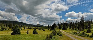

Sun
| today | tomorrow | day after tomorrow | |
|---|---|---|---|
| Dawn: | 6:20 | 6:21 | 6:23 |
| Sunrise: | 6:53 | 6:55 | 6:56 |
| Sunset: | 16:43 | 16:41 | 16:39 |
| Dusk: | 17:16 | 17:14 | 17:13 |