Pažení (1281 m a.s.l., Šumava)
Register and log summit
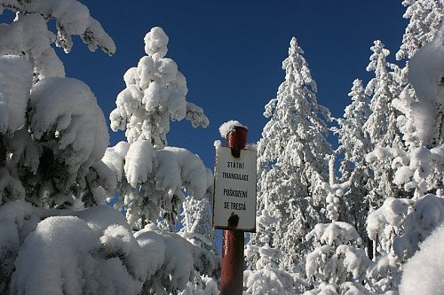

About Pažení
 Česko
Prachatice (Jihočeský kraj)
Logged on Vrcholovka 20x in total. Peak information here was completed by Martin Matějka a Michal Kříž.
Pažení is part of challenges: Šumavské tisícovky, The Highest Peaks of South Bohemia, Thousanders of the Czech Republic
The geodetic pole is overgrown with young dense spruce forest.
- Chalet/accommodation
-
There is no chalet on the peak.
- Stroller access
-
Peak is not stroller accessible.
- Views
-
There are no views from the peak.
- Cable car
-
There is no cable car to this peak.
- Equipment
-
No special equipment is required for this summit.
- Accessibility
-
The summit is located (albeit only about 60 m) in the Boubín Primeval Forest National Nature Reserve, where entry off marked paths is prohibited...
Nearest peaks: Pažení J (1229 m, 0.7 km) Basumský hřeben (1290 m, 0.8 km) Červený vrch (1203 m, 1 km) Basumský hřeben S (1290 m, 1.2 km) Jilmová skála (1037 m, 1.6 km) Medvědí hrb (969 m, 2.1 km) Srní hlava (1269 m, 2.1 km) Obrovec JV (1101 m, 2.6 km) Srní vrch (1298 m, 2.6 km) Mlýnský vršek (831 m, 2.9 km) Boubín (1362 m, 3.1 km) Šarapák (844 m, 3.1 km)
Routes nearby
Routes provided by SvetOutdooru.cz
Webcams on Pažení
Cameras provided by windy.com

Sun
| today | tomorrow | day after tomorrow | |
|---|---|---|---|
| Dawn: | 7:03 | 7:05 | 7:06 |
| Sunrise: | 7:36 | 7:37 | 7:39 |
| Sunset: | 18:02 | 18:00 | 17:58 |
| Dusk: | 18:34 | 18:32 | 18:31 |