




Hiking
pá, 20.9.2024, 15:10
 Německo
Logged on Vrcholovka 2x in total. Vrchol Sphinx was added here by Bouřka and info was completed by Bouřka a Martin Matějka.
The height of the peak on mapy.cz is most likely incorrect, as there is nothing in the area that significantly exceeds the surrounding contour lines. However, the situation around the summit is extremely complicated; it is difficult to move here (young spruces, stones, cliffs) and even harder to assess what constitutes the summit. There are two formations about 100m apart that could be considered:
- the southern one, which has a hint of a path leading from the south, but it does not seem to have prominence
- the northern one, which definitely has prominence, but it is a rock that can be climbed, albeit at a solid II degree of difficulty.
Both peaks offer limited views and are a nice wild spot. Here I include a photo and the prominence of the northern "summit," although probably no one will climb it. One can definitely be satisfied with the southern one.
There is no chalet on the peak.
Peak is not stroller accessible.
Partial.
There is no cable car to this peak.
No special equipment is required for this summit.
Peak is freely accessible.
Nearest peaks: Hörndl (1024 m, 0.3 km) Hörndl J (1015 m, 0.4 km) Schneiderberg (1015 m, 0.8 km) Hochsätter (1086 m, 0.9 km) Hochsätter SZ (1084 m, 0.9 km) Sphinx S (865 m, 0.9 km) Kleiner Arber S (1028 m, 1.2 km) Bärenriegel (1078 m, 1.3 km) Schwarzeck JV (1224 m, 1.6 km) Reischfleck (1148 m, 1.7 km) Reischfleck SZ (1146 m, 1.8 km) Sollerberg (886 m, 1.8 km) Sollerberg S (875 m, 1.8 km) Schwarzeck (1235 m, 1.9 km) Schwarzeck SZ (1233 m, 1.9 km) Spitzberg (1058 m, 2.3 km) Enzian (1287 m, 2.4 km) Heugstatt (1262 m, 2.4 km) Heugstatt JV (1227 m, 2.4 km) Hochstein (1134 m, 3.1 km) Hochstein J (1078 m, 3.3 km) Schobereck (1223 m, 3.3 km)
 Výstup na Großer Arber neboli Velký Javor v Bavorském lese
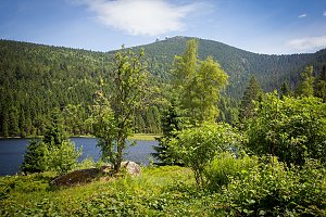 Přechod 12 tisícovek v Bavorském lese
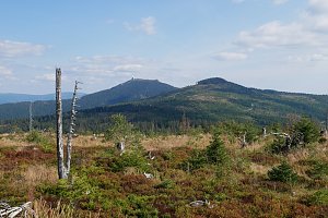 Výstup z Německa na Grosser Osser neboli Velký Ostrý na Šumavě
 Bayerisch Eisenstein: Berghaus Sonnenfels - Großer Arber- Blick nach Nordwesten
 Bayerisch Eisenstein › North-east: Großer Arber - Arber-Stadl
 Brennes › South-West: Grosser Arber Talstation
 Bayerisch Eisenstein › East
 Grosser Arber: Bodenmais Tourism & Marketing GmbH − Silberberg − Naturpark Bayerischer Wald e.V. − Czechia
 Bayerisch Eisenstein: Steinberglift - Bayerischen Wald
 Eggersberg: Grosser Osser − Ostrý
 Drachselsried: *s Hotel Lindenwirt - Blick ins Zellertal

| today | tomorrow | day after tomorrow | |
|---|---|---|---|
| Dawn: | 7:08 | 7:09 | 6:11 |
| Sunrise: | 7:40 | 7:42 | 6:44 |
| Sunset: | 18:03 | 18:01 | 16:59 |
| Dusk: | 18:35 | 18:33 | 17:31 |

