Landfriedstein (2536 m a.s.l., Dachstein)
Register and log summit


About peak Landfriedstein
 Rakousko
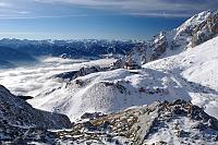
Vrchol Landfriedstein was added here by Jiří Králík.
There is no marked trail here, but the route along the ridge will not be difficult.
Photo: Jiří Králík
- Chalet/accommodation
-
There is no chalet on the peak.
- Stroller access
-
Peak is not stroller accessible.
- Views
-
There are views from the peak.
- Cable car
-
There is no cable car to this peak.
- Equipment
-
No special equipment is required for this summit.
- Accessibility
-
Peak is freely accessible.
Nearest peaks: Eselstein (2552 m, 1.1 km) Eselstein SV (2326 m, 1.2 km) Kleiner Rams (2390 m, 1.2 km) Hohe Rams (2551 m, 1.4 km) Untere Rams (2526 m, 1.4 km) Scheichenspitze (2667 m, 1.6 km) Scheichenfelsen (2635 m, 1.7 km) Scheichenhügel (2644 m, 1.8 km) Schmiedstock (2650 m, 1.9 km) Hohe Gamsfeldspitze (2665 m, 2 km) Kleiner Schmied (2614 m, 2 km) Fluderspitze (2612 m, 2.1 km) Grosser Koppenkarstein (2863 m, 2.1 km) Mitterstein (2060 m, 2.1 km) Ramsauer Ostspitze (2618 m, 2.1 km) Niedere Gamsfeldspitze (2604 m, 2.2 km) Ramsauer Mittlererspitze (2613 m, 2.2 km) Ramsauer Westspitze (2612 m, 2.2 km) Sinabell (2349 m, 2.2 km) Kampspitze (2086 m, 3.1 km)
Routes nearby
(elevation gain 1900 m, 30 km)
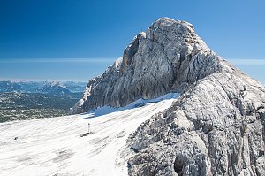 Vrchol Dachsteinu z Hallstattu
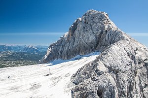 Dachstein z jihu od Ramsau
Okruh po horských chatách kolem Dachsteinu
(elevation gain 2900 m, 39 km)
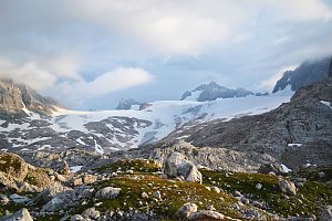 Okruh přes Hoher Dachstein
(elevation gain 300 m, 10 km)

Webcams
(-32768 m a.s.l., 3.1 km)
 Ramsau am Dachstein: Hauser Kaibling - Schladming - Dachstein
(-32768 m a.s.l., 3.1 km)
 Ramsau am Dachstein: Hauser Kaibling - Schladming - Dachstein
(-32768 m a.s.l., 3.1 km)
 Schildlehen: Hauser Kaibling − Schladming − Dachstein
(2560 m a.s.l., 3.1 km)
 Schildlehen: Hauser Kaibling − Schladming − Dachstein
(2560 m a.s.l., 3.1 km)
 Obertraun: Ramsau a. D. - Dachstein
(-32768 m a.s.l., 3.2 km)
 Schladming: Bergstation Dachstein Hunerkogel
( 3.2 km)
 Ramsau am Dachstein: Ramsau - Lindenhof - Ramsbergerhof - Blick zum Dachstein
(1196 m a.s.l., 4.3 km)
 Ramsau: Rittisberg in − am Dachstein
(1148 m a.s.l., 4.5 km)
 Ramsau: am Dachstein
(1123 m a.s.l., 4.6 km)
 Hallstatt: Dachstein - Simonyhütte - Blick zum Hallstättergletscher
(2184 m a.s.l., 5.3 km)
 Hallstatt › South: Hallstätter Glacier
( 5.3 km)
 Ramsau am Dachstein: Ramsau Am Dachstein - Langlaufstadion - Scheichenspitze
(1130 m a.s.l., 5.7 km)
 Obertraun: Dachstein Salzkammergut - Krippenstein Bergstation
( 6.9 km)
 Obertraun: Dachstein Salzkammergut - Krippenstein Bergstation 4SL
( 6.9 km)
 Hallstatt › South-West
( 7.1 km)
 Hallstatt › North-West
( 7.1 km)
 Hallstatt › North-West
( 7.2 km)

Sun
| today | tomorrow | day after tomorrow | |
|---|---|---|---|
| Dawn: | 7:04 | 7:05 | 6:07 |
| Sunrise: | 7:35 | 7:37 | 6:38 |
| Sunset: | 18:03 | 18:01 | 17:00 |
| Dusk: | 18:35 | 18:33 | 17:31 |