





Other activity, 13 km
11.6.2022
 Rakousko
Logged on Vrcholovka 6x in total. Vrchol Stein am Mandl was added here by Martin Malý and info was completed by Martin Matějka, Jiří Králík a Profesorskey - Jan Bratt.
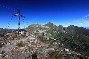
Stein am Mandl is located at the end of the ridge extending from Grosser Bösenstein to the northwest. Below the eastern slope, you will find the Rottenmanner Hütte. I recommend a beautiful easy day loop from the town of Rottenmann, passing through Stein am Mandl, Seegupf, Diewaldgupf, Moserspitz, Hochhaide, and back.
There is a chalet on the peak.
Peak is not stroller accessible.
There are views from the peak.
There is no cable car to this peak.
No special equipment is required for this summit.
Peak is freely accessible.
Nearest peaks: Seegupf (2011 m, 1.1 km) Klein Seegupf (2008 m, 1.2 km) Sternkegel (1880 m, 1.2 km) Hochspitz (1155 m, 1.9 km) Diewaldgupf (2125 m, 2 km) Moserspitz (2230 m, 2.7 km)
| today | tomorrow | day after tomorrow | |
|---|---|---|---|
| Dawn: | 6:07 | 6:08 | 6:10 |
| Sunrise: | 6:38 | 6:40 | 6:41 |
| Sunset: | 16:54 | 16:52 | 16:50 |
| Dusk: | 17:25 | 17:24 | 17:22 |


