





Hiking
čt, 31.3.2022, 7:20
 Rakousko
Logged on Vrcholovka 1x in total. Peak information here was completed by Martin Matějka.
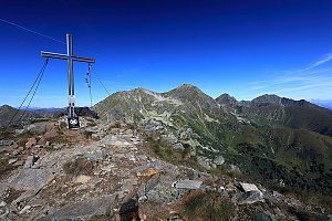
A rock with a terrace. The hut at the top is marked with the Alpenverein sign, but there is a sign at the bottom stating private property.
There is a chalet on the peak.
Peak is not stroller accessible.
There are views from the peak.
There is no cable car to this peak.
I
The place was deserted during our visit. A sign stating enter at your own risk is covered by a prohibition sign.
Nearest peaks: Sternkegel (1880 m, 1.8 km) Stein am Mandl (2043 m, 1.9 km) Seegupf (2011 m, 2.8 km) Klein Seegupf (2008 m, 2.9 km) Horngrund (2108 m, 3.8 km)
| today | tomorrow | day after tomorrow | |
|---|---|---|---|
| Dawn: | 7:01 | 7:02 | 6:04 |
| Sunrise: | 7:32 | 7:34 | 6:35 |
| Sunset: | 18:00 | 17:59 | 16:57 |
| Dusk: | 18:32 | 18:30 | 17:28 |