


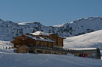


Ski touring
ne, 18.5.2025, 0:00
 Itálie
Logged on Vrcholovka 3x in total. Peak information here was completed by Martin Matějka, Bouřka a Martin Malý.
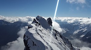
Königspitze, or Gran Zebrù in Italian, is the second highest mountain in the Ortler range. Only the emblematic Ortler (3905 m) is 50 m taller. In its shadow, Königspitze remains somewhat overlooked. Nevertheless, it is a beautiful mountain with a thin, roof-like ridge at the summit. To reach it, we must overcome slopes with a minimum incline of 45°.
(photo and text taken from goat.cz, prominence from peakvisor.com, goat.cz states 388 m)
The normal route from rif. Pizzini (or rif. Casati) leads over steep slopes with inclines of up to 50° and a total elevation gain of 650 m, difficulty AD (source: summitpost.org)
The starting point for the normal route is the Pizzini hut, 2706 m.
Peak is not stroller accessible.
There are views from the peak.
There is no cable car to this peak.
Glacier equipment required.
Peak is freely accessible.
Nearest peaks: Monte Zebrù (3735 m, 2.1 km) Cima Zebrù (3119 m, 3 km)
 Výstup na horolezecké lákadlo Jižního Tyrolska - Ortler
 Vysokohorská hřebenovka Monte Cevedale - Monte Vioza s možným výstupem na Gran Zebrú
 Sulden - Solda: Madritsch Sessellift
 Sulden - Solda
 Sulden - Solda
 Sulden - Solda
 Valfurva
 Valfurva › North-West
 Stilfs - Stelvio: Madritsch Sulden
 Martell - Martello: Die Gletscher des Cevedale-Gebiets | I ghiacciai del Cevedale - Südtirol | Val - Alto Adige
 Stilfs - Stelvio: Sulden - Madritsch
 Stilfs - Stelvio: Sulden - Übungshang Cevedale - Talstation
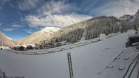 Sulden - Solda: Übungshang Cevedale - Talstation
 Albergo della Posta: Solda − Ortles
 Stilfs - Stelvio: Kanzel - Sulden
 Solda: Blick zur Seilbahn
 Solda: Langenstein Kanzel
 Valfurva: Santa Caterina - I Forni, Ski area Santa Caterina
 Valfurva: Santa Caterina - I Forni, Valle dei Forni
 Valfurva: Santa Caterina - I Forni, Ghiacciaio dei Forni
| today | tomorrow | day after tomorrow | |
|---|---|---|---|
| Dawn: | 6:25 | 6:26 | 6:27 |
| Sunrise: | 6:56 | 6:57 | 6:59 |
| Sunset: | 17:06 | 17:04 | 17:03 |
| Dusk: | 17:37 | 17:36 | 17:34 |

