Oravská kotlina
| Highest peak | Výr (837 m a.s.l.) |
|---|---|
| Most prominent peak | Staré lazy (697 m a.s.l., prominence 50 m) |
| Parent unit | Podhôľno-magurská oblast |
| Main peaks | Total 5 |
| Most popular peaks | Slanický ostrov (609 m a.s.l.), Staré lazy (697 m a.s.l.), Výr (837 m a.s.l.), Závrch (666 m a.s.l.), Obłazowa (670 m a.s.l.) |
| Mountain range challenges | Highest Points of Geomorphological Units of Slovakia |

| Name | Elevation | ||||
|---|---|---|---|---|---|

|
Výr | 837 m a.s.l. | Oravská kotlina | 5 m | vedlejší vrchol |

|
Nižný grúň | 790 m a.s.l. | Oravská kotlina | 3 m | spočinek/ostatní |

|
Opálený | 753 m a.s.l. | Oravská kotlina | 9 m | vedlejší vrchol |
|
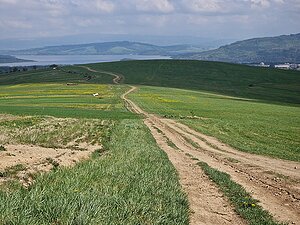
Kunov vrch | 744 m a.s.l. | Oravská kotlina | 16 m | hlavní vrchol |

|
Hruštín | 735 m a.s.l. | Oravská kotlina | 15 m | hlavní vrchol |

|
Staré lazy | 697 m a.s.l. | Oravská kotlina | 50 m | hlavní vrchol |
|
Bobrovský grúň | 693 m a.s.l. | Oravská kotlina | 7 m | vedlejší vrchol |
|
Kuhajdová | 673 m a.s.l. | Oravská kotlina | 14 m | vedlejší vrchol |

|
Jurčová | 671 m a.s.l. | Oravská kotlina | 8 m | vedlejší vrchol |

|
Obłazowa | 670 m a.s.l. | Oravská kotlina | 40 m | hlavní vrchol |

|
Závrch | 666 m a.s.l. | Oravská kotlina | 41 m | hlavní vrchol |

|
Príbojec | 657 m a.s.l. | Oravská kotlina | 9 m | vedlejší vrchol |
|
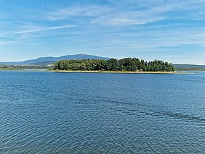
Slanický ostrov | 609 m a.s.l. | Oravská kotlina | 8 m | vedlejší vrchol |