Rosengarten
| Highest peak | Kesselkogel / Catinaccio d'Antermoia (3003 m a.s.l.) |
|---|---|
| Most prominent peak | Kesselkogel / Catinaccio d'Antermoia (3003 m a.s.l., prominence 815 m) |
| Parent unit | Western Dolomites |
| Main peaks | Total 14 |
| Most popular peaks | Rotwand (2806 m a.s.l.), Kesselkogel / Catinaccio d'Antermoia (3003 m a.s.l.), Col de Ciampac (2316 m a.s.l.), Testone del Vaiolon (2646 m a.s.l.), Torre Stabeler (2805 m a.s.l.) |

| Name | Elevation | ||||
|---|---|---|---|---|---|
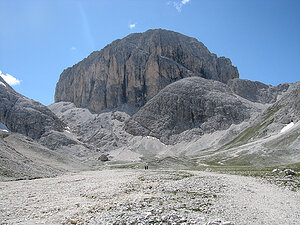
|
Kesselkogel / Catinaccio d'Antermoia | 3003 m a.s.l. | Rosengarten | 815 m | hlavní vrchol |

|
Cima di Larsec | 2891 m a.s.l. | Rosengarten | 124 m | hlavní vrchol |

|
Cima di Laussa | 2876 m a.s.l. | Rosengarten | 60 m | hlavní vrchol |

|
Rotwand | 2806 m a.s.l. | Rosengarten | 246 m | hlavní vrchol |

|
Torre Stabeler | 2805 m a.s.l. | Rosengarten | 168 m | hlavní vrchol |

|
Torre Winkler | 2800 m a.s.l. | Rosengarten | 82 m | hlavní vrchol |

|
Torre Delago | 2790 m a.s.l. | Rosengarten | 110 m | hlavní vrchol |

|
Crepes de Lausa | 2766 m a.s.l. | Rosengarten | 58 m | hlavní vrchol |

|
Testone del Rifugio | 2651 m a.s.l. | Rosengarten | 52 m | hlavní vrchol |
|
|
Testone del Vaiolon | 2646 m a.s.l. | Rosengarten | 34 m | hlavní vrchol |
|
|
Mantel | 2567 m a.s.l. | Rosengarten | 57 m | hlavní vrchol |

|
Col de Ciampac | 2316 m a.s.l. | Rosengarten | 40 m | hlavní vrchol |

|
Mont de Cepëi (Punta d'Oro) - Goldknopf | 2248 m a.s.l. | Rosengarten | 60 m | hlavní vrchol |

|
Col dal Spiedl - Grunserbühl | 2177 m a.s.l. | Rosengarten | 30 m | hlavní vrchol |