Geisler
| Highest peak | Furchetta / Furchëta (3025 m a.s.l.) |
|---|---|
| Most prominent peak | Furchetta / Furchëta (3025 m a.s.l., prominence 904 m) |
| Parent unit | Western Dolomites |
| Main peaks | Total 5 |
| Most popular peaks | Seceda (2519 m a.s.l.), Sas Rigais (3025 m a.s.l.), Sëurasas (2176 m a.s.l.), Piza da la Creusc (2480 m a.s.l.), Col dala Crëusc (2490 m a.s.l.) |

| Name | Elevation | ||||
|---|---|---|---|---|---|
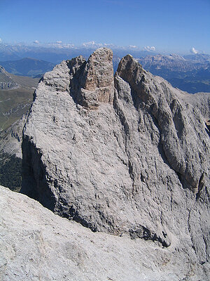
|
Furchetta / Furchëta | 3025 m a.s.l. | Geisler | 904 m | hlavní vrchol |

|
Sas Rigais | 3025 m a.s.l. | Geisler | 336 m | hlavní vrchol |

|
Seceda | 2519 m a.s.l. | Geisler | 72 m | hlavní vrchol |

|
Col dala Crëusc | 2490 m a.s.l. | Geisler | 13 m | vedlejší vrchol |

|
Piza da la Creusc | 2480 m a.s.l. | Geisler | 3 m | spočinek/ostatní |

|
Monte Pic / Pitschberg | 2363 m a.s.l. | Geisler | 200 m | hlavní vrchol |

|
Sëurasas | 2176 m a.s.l. | Geisler | 47 m | hlavní vrchol |