Bosconero
| Highest peak | Sasso di Bosconero (2469 m a.s.l.) |
|---|---|
| Most prominent peak | Sasso di Bosconero (2469 m a.s.l., prominence 938 m) |
| Parent unit | Eastern Dolomites |
| Main peaks | Total 5 |
| Most popular peaks | Sfornioi Nord (2410 m a.s.l.), Sfornioi di Mezzo (2425 m a.s.l.), Sassolungo di Cibiana (2413 m a.s.l.), Sasso di Bosconero (2469 m a.s.l.), Sfornioi Sud (2407 m a.s.l.) |

| Name | Elevation | ||||
|---|---|---|---|---|---|
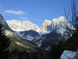
|
Sasso di Bosconero | 2469 m a.s.l. | Bosconero | 938 m | hlavní vrchol |

|
Sfornioi di Mezzo | 2425 m a.s.l. | Bosconero | 162 m | hlavní vrchol |

|
Sassolungo di Cibiana | 2413 m a.s.l. | Bosconero | 338 m | hlavní vrchol |

|
Sfornioi Nord | 2410 m a.s.l. | Bosconero | 55 m | hlavní vrchol |

|
Sfornioi Sud | 2407 m a.s.l. | Bosconero | 172 m | hlavní vrchol |