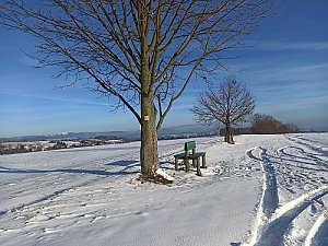
Okolo Vysokého nad Jizerou

Export peaks

Export generates a GPX file with peaks that can be uploaded to GPS navigation or phone app.

Plan route

Click a peak or chalet and then "Add to planning" to add route points. You can also add points by right-clicking on the map.
After page reload, route planning is lost.

    Chalets

    Filters only chalets where this feature is filled in.

    By summit history

    Legend

    Green points are visited peaks, red points are not visited.
    PeakPeaks with prominence 15 m and more
    Secondary peakPeaks with prominence 5-15 m
    Point of interestSignificant point with minimum prominence created for challenge purposes
    Rest pointElevation point with prominence below 5 m
    UnclassifiedPeaks waiting for classification
    ChaletMountain chalet

    Challenges

    Peaks


    Filters only peaks where this feature is filled in.
    m
    m
    m
    m
    m
    m
    Not all peaks have listed isolation.
    Na Letišti
    659 m n.m.
    Added 31.7.2024
    Chlum
    696 m n.m.
    Added 31.7.2024
    Na Kamenci
    688 m n.m.
    Added 31.7.2024
    Šibeniční vrch
    692 m n.m.
    Added 31.7.2024
    Barejtův kopec
    653 m n.m.
    Added 18.6.2020
    Buč
    652 m n.m.
    Added 18.6.2020
    Petruškovy vrchy
    720 m n.m.
    Added 16.7.2020
    Praškova skála
    686 m n.m.
    Added 21.5.2023
    Tomášovy vrchy
    717 m n.m.
    Added 18.6.2020
    Javorník
    822 m n.m.
    Added 21.5.2023
    Bílá skála
    968 m n.m.
    Added 16.11.2019
    Čertovka
    615 m n.m.
    Added 7.3.2023
    Farský kopec
    625 m n.m.
    Added 31.7.2024
    Hvězda
    959 m n.m.
    Added 25.11.2019
    Hrobka
    510 m n.m.
    Added 14.1.2024
    Kapradník
    954 m n.m.
    Added 21.5.2023
    Hromovka
    917 m n.m.
    Added 5.9.2023
    Návarov
    420 m n.m.
    Added 28.1.2023
    Noskův kopec
    673 m n.m.
    Added 13.6.2025
    Share