




Hiking, 10 km
11.9.2024
 Česko
Semily (Liberecký kraj)
Logged on Vrcholovka 8x in total. Spočinek Barejtův kopec was added here by Iveta Válová and info was completed by Martin Matějka a Jana.
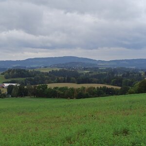
Geodetic point in a field, with views but without prominence.
There is no chalet on the peak.
Easy walk with a stroller, the ascent is barrier-free, essentially flat on a gravel path. Follow the blue hiking trail from Vysoké.
View of the town of Vysoké nad Jizerou and the lookout tower near Borovice in Roprachtice.
There is no cable car to this peak.
No special equipment is required for this summit.
Peak is freely accessible.
Nearest peaks: Buč (652 m, 1.6 km) Šibeniční vrch (692 m, 1.6 km) Petruškovy vrchy (720 m, 1.7 km) Na Kamenci (688 m, 2.5 km) Noskův kopec (673 m, 2.6 km)
 Jablonec nad Jizerou: Kamenec
 Korenov › South-West: Ski resort Rejdice
 Korenov › South-West: Rejdice
 Paseky nad Jizerou
 Svárov
 Šumburk nad Desnou: Snowpark Rejdice
 Korenov › North-West
 Rokytnice nad Jizerou
 Korenov › South-East: U čápa Příchovice
 Korenov › North-East: U čápa Příchovice - Kostel sv. Víta

| today | tomorrow | day after tomorrow | |
|---|---|---|---|
| Dawn: | 6:07 | 6:09 | 6:10 |
| Sunrise: | 6:41 | 6:43 | 6:44 |
| Sunset: | 16:43 | 16:41 | 16:39 |
| Dusk: | 17:17 | 17:15 | 17:13 |


